
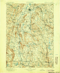
~ Housatonic MA topo map, 1:125000 scale, 30 X 30 Minute, Historical, 1900, updated 1905
Housatonic, Massachusetts, USGS topographic map dated 1900.
Includes geographic coordinates (latitude and longitude). This topographic map is suitable for hiking, camping, and exploring, or framing it as a wall map.
Printed on-demand using high resolution imagery, on heavy weight and acid free paper, or alternatively on a variety of synthetic materials.
Topos available on paper, Waterproof, Poly, or Tyvek. Usually shipping rolled, unless combined with other folded maps in one order.
- Product Number: USGS-5636139
- Free digital map download (high-resolution, GeoPDF): Housatonic, Massachusetts (file size: 11 MB)
- Map Size: please refer to the dimensions of the GeoPDF map above
- Weight (paper map): ca. 55 grams
- Map Type: POD USGS Topographic Map
- Map Series: HTMC
- Map Verison: Historical
- Cell ID: 65707
- Scan ID: 353197
- Imprint Year: 1905
- Survey Year: 1888
- Datum: Unstated
- Map Projection: Unstated
- Map published by United States Geological Survey
- Map Language: English
- Scanner Resolution: 600 dpi
- Map Cell Name: Housatonic
- Grid size: 30 X 30 Minute
- Date on map: 1900
- Map Scale: 1:125000
- Geographical region: Massachusetts, United States
Neighboring Maps:
All neighboring USGS topo maps are available for sale online at a variety of scales.
Spatial coverage:
Topo map Housatonic, Massachusetts, covers the geographical area associated the following places:
- Glendale - Housatonic - Hinsdale - West Becket - Yankee Orchards - Hephzibah Heights - Camp Russell - Coltsville - New Marlborough - Camp Marion White - Dalton - Wangum Village - Camp Becket - Clayton - Interlaken - Great Barrington - Camp Taconic - Taconic - Risingdale - Konkapot - Camp Sumner - Crane Lake Camp - Skyland - New Lenox - Twin Lakes - The Boulders - Bonny Rigg Corners - Cold Spring - Camp Spruce Hill - East Lee - Hansons Mobile Home Park - Van Deusenville - Tyringham - Canaan Center - Camp Chimney Corners - East Otis - Camp Stevenson - Monterey - West Stockbridge Center - Alford - Eastover - Tanglewood - Barkerville - East Canaan - Camp Jayson - Pontoosuc - Becket Center - Peru - Hammertown - Victory Hill - New Britain (historical) - New Lebanon Center - Hancock Shaker Village - Green Ridge Park - Leisure Lee - Otis Wood Lanes - Egremont Plain - South Lee - West Otis - South Sandisfield - Beechwood Estates - Lebanon Springs - Hartsville - Roosterville - Austerlitz - Adams Junction - Berkshire Heights - Tolland Center - Camp Lenore - Bancroft - North Otis - Mill River - Camp Greylock - Camp Merrill - Weatogue - Richmond - Lenox Station - Alander - Richmond Furnace - Sheffield - South Egremont - Joyceville - Lenox Dale - Algerie Four Corners - Stockbridge - Montville - Beachwood - Brookside - East Sheffield - North Colebrook - West Pittsfield - Ashley Falls - Stearnsville - Rockdale Mills - Adams Crossing Mobile Home Park - Green River - Camp Kingsmont - New Lebanon - North Egremont - Belcher Square
- Map Area ID: AREA42.542-73.5-73
- Northwest corner Lat/Long code: USGSNW42.5-73.5
- Northeast corner Lat/Long code: USGSNE42.5-73
- Southwest corner Lat/Long code: USGSSW42-73.5
- Southeast corner Lat/Long code: USGSSE42-73
- Northern map edge Latitude: 42.5
- Southern map edge Latitude: 42
- Western map edge Longitude: -73.5
- Eastern map edge Longitude: -73


