
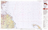
~ Provincetown MA topo map, 1:100000 scale, 30 X 60 Minute, Historical, 1984, updated 1994
Provincetown, Massachusetts, USGS topographic map dated 1984.
Includes geographic coordinates (latitude and longitude). This topographic map is suitable for hiking, camping, and exploring, or framing it as a wall map.
Printed on-demand using high resolution imagery, on heavy weight and acid free paper, or alternatively on a variety of synthetic materials.
Topos available on paper, Waterproof, Poly, or Tyvek. Usually shipping rolled, unless combined with other folded maps in one order.
- Product Number: USGS-5636111
- Free digital map download (high-resolution, GeoPDF): Provincetown, Massachusetts (file size: 30 MB)
- Map Size: please refer to the dimensions of the GeoPDF map above
- Weight (paper map): ca. 55 grams
- Map Type: POD USGS Topographic Map
- Map Series: HTMC
- Map Verison: Historical
- Cell ID: 72651
- Scan ID: 353180
- Imprint Year: 1994
- Woodland Tint: Yes
- Photo Inspection Year: 1988
- Aerial Photo Year: 1983
- Edit Year: 1984
- Datum: NAD27
- Map Projection: Universal Transverse Mercator
- Map published by United States Geological Survey
- Map Language: English
- Scanner Resolution: 600 dpi
- Map Cell Name: Provincetown
- Grid size: 30 X 60 Minute
- Date on map: 1984
- Map Scale: 1:100000
- Geographical region: Massachusetts, United States
Neighboring Maps:
All neighboring USGS topo maps are available for sale online at a variety of scales.
Spatial coverage:
Topo map Provincetown, Massachusetts, covers the geographical area associated the following places:
- Lovell Corners - Second Cliff - Gurneys Corner - Swampscott - Ocean Bluff - Mercer Square - Winthrop - Weymouth Landing - West Hingham - North Hanson - First Cliff - Miles Standish Park - Bryantville - Crow Point - Weymouth Heights - Rock Island - Winslows Crossing - Burrage - Sherman Corner - Hingham Center - Sand Hills - Kings Landing - Matfield Junction - Tinkertown - Duxbury - West Abington - Manns Corner - Kent Park - Adams Shore - Lynn - Raddin Station - Beaver - East Lynn - Beechwood - Marshfield Hills - Quincy Neck - South Hingham - Fort Dawes - Hanover Center - Standish - Tuttleville - Fort Duvall - Coxs Corner - Westdale - Clapps Corner - Fort Andrews - Norwell Homes - Cox Corner - Brimstone Corner - Crescent Beach - Pilgrim Heights - Manson Corner - Fort Hill - Merrymount - Wingbrook Estates - Post Island - Oldham Pines - West Hanover - Waveland - Clifton - Hanson - South Braintree - Green Harbor - Minot - Houghs Neck - North Cohasset - Tree of Knowledge Corner - Accord - Quincy Point - Nantasket Junction - Sea View - Winthrop Beach - East Braintree - Third Cliff - Curtisville - South Hanover - Mayflower Heights - Winslow Estates - Lincoln Heights - Norwell - Braintree - Reeds Corner - Marshfield Center - Cedar Crest - Cottage Park - North Scituate - Allerton - Scituate - Liberty Plain - Finnville - Drumlin Farms - Hanover - Wood End - Mann Hill Beach - Court Park - Humarock - North Pembroke - Hingham - Schoosett - Northwest Duxbury
- Map Area ID: AREA42.542-71-70
- Northwest corner Lat/Long code: USGSNW42.5-71
- Northeast corner Lat/Long code: USGSNE42.5-70
- Southwest corner Lat/Long code: USGSSW42-71
- Southeast corner Lat/Long code: USGSSE42-70
- Northern map edge Latitude: 42.5
- Southern map edge Latitude: 42
- Western map edge Longitude: -71
- Eastern map edge Longitude: -70


