
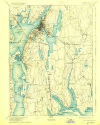
~ Fall River MA topo map, 1:62500 scale, 15 X 15 Minute, Historical, 1893, updated 1925
Fall River, Massachusetts, USGS topographic map dated 1893.
Includes geographic coordinates (latitude and longitude). This topographic map is suitable for hiking, camping, and exploring, or framing it as a wall map.
Printed on-demand using high resolution imagery, on heavy weight and acid free paper, or alternatively on a variety of synthetic materials.
Topos available on paper, Waterproof, Poly, or Tyvek. Usually shipping rolled, unless combined with other folded maps in one order.
- Product Number: USGS-5635381
- Free digital map download (high-resolution, GeoPDF): Fall River, Massachusetts (file size: 8 MB)
- Map Size: please refer to the dimensions of the GeoPDF map above
- Weight (paper map): ca. 55 grams
- Map Type: POD USGS Topographic Map
- Map Series: HTMC
- Map Verison: Historical
- Cell ID: 54061
- Scan ID: 352622
- Imprint Year: 1925
- Survey Year: 1885
- Datum: NAD
- Map Projection: Polyconic
- Map published by United States Geological Survey
- Map Language: English
- Scanner Resolution: 600 dpi
- Map Cell Name: Fall River
- Grid size: 15 X 15 Minute
- Date on map: 1893
- Map Scale: 1:62500
- Geographical region: Massachusetts, United States
Neighboring Maps:
All neighboring USGS topo maps are available for sale online at a variety of scales.
Spatial coverage:
Topo map Fall River, Massachusetts, covers the geographical area associated the following places:
- Steep Brook - Common Fence Point - Kempton Croft - Westport Factory - The Hummocks - Lakeside - Mechanicsville - Coggeshall - Swansea - Hixville - Oak Grove Village - Luther Corner - Russells Mills - Acoaxet - Snell Corner - Giffords Corner - Suburban Park - Hillcrest - Swansea Center - Pottersville - Head of Westport - Brownell Corner - Sissons Corner - Portsmouth Park - South Swansea - Handy Four Corners - Brayton Point - Fall River - Fighting Rock Corner - Booth Corner - Berryman Corner - Gidleys Corner - Adamsville - Ocean Grove - Island Park - Slades Corner - Camp Noquochoke - Touisset Highlands - Tiverton - Fall River Station - North Tiverton - Touisset - Slocums Corner - Globe Village - University Highlands - Eagleville - Slades Ferry - Bridgeport (historical) - Grayville - Flint Village - Little Compton - Westport Point - Woods Corner - Tiverton Four Corners - Montop (historical) - Collins Corner - Kirby Corner - Macombers Corner - Central Village - Bowenville - South Westport - Bliss Corners - Beulah Corners - North Westport
- Map Area ID: AREA41.7541.5-71.25-71
- Northwest corner Lat/Long code: USGSNW41.75-71.25
- Northeast corner Lat/Long code: USGSNE41.75-71
- Southwest corner Lat/Long code: USGSSW41.5-71.25
- Southeast corner Lat/Long code: USGSSE41.5-71
- Northern map edge Latitude: 41.75
- Southern map edge Latitude: 41.5
- Western map edge Longitude: -71.25
- Eastern map edge Longitude: -71


