
~ Polar Bear Mountain CA topo map, 1:24000 scale, 7.5 X 7.5 Minute, Historical, 2012
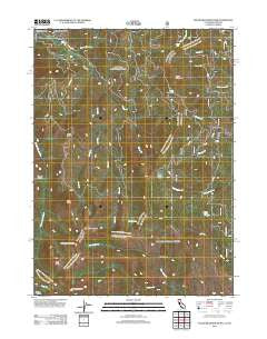
Polar Bear Mountain, California, USGS topographic map dated 2012.
Includes geographic coordinates (latitude and longitude). This topographic map is suitable for hiking, camping, and exploring, or framing it as a wall map.
Printed on-demand using high resolution imagery, on heavy weight and acid free paper, or alternatively on a variety of synthetic materials.
Topos available on paper, Waterproof, Poly, or Tyvek. Usually shipping rolled, unless combined with other folded maps in one order.
- Product Number: USGS-5633869
- Free digital map download (high-resolution, GeoPDF): Polar Bear Mountain, California (file size: 27 MB)
- Map Size: please refer to the dimensions of the GeoPDF map above
- Weight (paper map): ca. 55 grams
- Map Type: POD USGS Topographic Map
- Map Series: US Topo
- Map Verison: Historical
- Cell ID: 35852
- Datum: North American Datum of 1983
- Map Projection: Transverse Mercator
- Map Cell Name: Polar Bear Mountain
- Grid size: 7.5 X 7.5 Minute
- Date on map: 2012
- Map Scale: 1:24000
- Geographical region: California, United States
Neighboring Maps:
All neighboring USGS topo maps are available for sale online at a variety of scales.
Spatial coverage:
Topo map Polar Bear Mountain, California, covers the geographical area associated the following places:
- Black Creek - Bell Echo Camp - Twin Valley - Bear Cub - Louse Creek - The Lieutenants - Little Grayback - Dunn Creek - Loretta Falls - Lookout Mountain - Copper Creek - Crazy Peak - Polar Bear Mountain - Orloff Mine - Kelly Lake - Mud Lake - North Fork Dunn Creek - Poker Creek - Black Butte - Porters Camp - Packers Creek - Sanger Canyon - Poker Flat
- Map Area ID: AREA4241.875-123.625-123.5
- Northwest corner Lat/Long code: USGSNW42-123.625
- Northeast corner Lat/Long code: USGSNE42-123.5
- Southwest corner Lat/Long code: USGSSW41.875-123.625
- Southeast corner Lat/Long code: USGSSE41.875-123.5
- Northern map edge Latitude: 42
- Southern map edge Latitude: 41.875
- Western map edge Longitude: -123.625
- Eastern map edge Longitude: -123.5


