
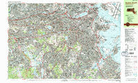
~ Boston South MA topo map, 1:25000 scale, 7.5 X 15 Minute, Historical, 1987, updated 1987
Boston South, Massachusetts, USGS topographic map dated 1987.
Includes geographic coordinates (latitude and longitude). This topographic map is suitable for hiking, camping, and exploring, or framing it as a wall map.
Printed on-demand using high resolution imagery, on heavy weight and acid free paper, or alternatively on a variety of synthetic materials.
Topos available on paper, Waterproof, Poly, or Tyvek. Usually shipping rolled, unless combined with other folded maps in one order.
- Product Number: USGS-5633591
- Free digital map download (high-resolution, GeoPDF): Boston South, Massachusetts (file size: 48 MB)
- Map Size: please refer to the dimensions of the GeoPDF map above
- Weight (paper map): ca. 55 grams
- Map Type: POD USGS Topographic Map
- Map Series: HTMC
- Map Verison: Historical
- Cell ID: 75144
- Scan ID: 350872
- Imprint Year: 1987
- Woodland Tint: Yes
- Visual Version Number: 1
- Aerial Photo Year: 1978
- Edit Year: 1987
- Field Check Year: 1979
- Datum: NAD27
- Map Projection: Universal Transverse Mercator
- Map published by United States Geological Survey
- Map Language: English
- Scanner Resolution: 600 dpi
- Map Cell Name: Boston South
- Grid size: 7.5 X 15 Minute
- Date on map: 1987
- Map Scale: 1:25000
- Geographical region: Massachusetts, United States
Neighboring Maps:
All neighboring USGS topo maps are available for sale online at a variety of scales.
Spatial coverage:
Topo map Boston South, Massachusetts, covers the geographical area associated the following places:
- Wollaston - Westbrook Village - Jamaica Plain - Newton Corner - Reservoir - Dedham Island - Ashmont - Montclair - Nonantum - Riverview - North Village - Coolidge Corner - Birds Hill - Brookline - Roxbury Crossing - West Quincy - East Cambridge - Dock Square - Newton Upper Falls - Chestnut Hill - Forest Hills - Needham Junction - Fort Independence - Norfolk Downs - East Milton - East Watertown - Squantum - Bellevue - Brighton - Cambridgeport - Watertown - Highland - Milton Upper Mills - Quincy - Downtown Crossing - Hyde Park - Roxbury - North End - Neponset - Thompsonville - Newton Center - Bay Village - New Squantum - Dorchester - Milton Village - Beacon Hill - Back Bay - Newton Highlands - Forest Hills - Allston - Dorchester Center - West Newton - Newtonville - Fort Winthrop (historical) - Beaconsfield - Oak Hill Park - Milton Center - Lower Mills - Newton - Woodland - Roslindale - Uphams Corner - Savin Hill - Mount Bowdoin - South Boston - Grove Hall - West Roxbury - Meeting House Hill - Clarendon Hills - Atlantic - Forbes Wharf - Fields Corner - Longwood Station - Aberdeen - Dorchester Heights - Boston - Eliot - Waban - Mount Ida - Coolidge Hill - Needham - Bemis - Faneuil - Mount Hope - Stonybrook Village - Mattapan - North Quincy - Germantown - East Dedham - Fairmount - City Point - Riverdale - Needham Heights - Jeffries Point - Milton Hill - Cedar Grove - Auburndale - Brookline Village - North Brighton
- Map Area ID: AREA42.37542.25-71.25-71
- Northwest corner Lat/Long code: USGSNW42.375-71.25
- Northeast corner Lat/Long code: USGSNE42.375-71
- Southwest corner Lat/Long code: USGSSW42.25-71.25
- Southeast corner Lat/Long code: USGSSE42.25-71
- Northern map edge Latitude: 42.375
- Southern map edge Latitude: 42.25
- Western map edge Longitude: -71.25
- Eastern map edge Longitude: -71


