
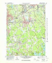
~ Whitman MA topo map, 1:25000 scale, 7.5 X 7.5 Minute, Historical, 1977, updated 1979
Whitman, Massachusetts, USGS topographic map dated 1977.
Includes geographic coordinates (latitude and longitude). This topographic map is suitable for hiking, camping, and exploring, or framing it as a wall map.
Printed on-demand using high resolution imagery, on heavy weight and acid free paper, or alternatively on a variety of synthetic materials.
Topos available on paper, Waterproof, Poly, or Tyvek. Usually shipping rolled, unless combined with other folded maps in one order.
- Product Number: USGS-5633493
- Free digital map download (high-resolution, GeoPDF): Whitman, Massachusetts (file size: 13 MB)
- Map Size: please refer to the dimensions of the GeoPDF map above
- Weight (paper map): ca. 55 grams
- Map Type: POD USGS Topographic Map
- Map Series: HTMC
- Map Verison: Historical
- Cell ID: 48898
- Scan ID: 351422
- Imprint Year: 1979
- Woodland Tint: Yes
- Visual Version Number: 1
- Aerial Photo Year: 1974
- Field Check Year: 1975
- Survey Year: 1936
- Datum: NAD27
- Map Projection: Polyconic
- Map published by United States Geological Survey
- Map Language: English
- Scanner Resolution: 600 dpi
- Map Cell Name: Whitman
- Grid size: 7.5 X 7.5 Minute
- Date on map: 1977
- Map Scale: 1:25000
- Geographical region: Massachusetts, United States
Neighboring Maps:
All neighboring USGS topo maps are available for sale online at a variety of scales.
Spatial coverage:
Topo map Whitman, Massachusetts, covers the geographical area associated the following places:
- East Bridgewater - Northville - Auburnville - Rye Hill - Satucket - Beaver - Matfield - Winslow Estates - Abington - South Hanson - Westdale - Coxs Corner - Drumlin Farms - Stanley - Elmwood - West Hanover - West Abington - Eastville - Whitman - North Hanson - Hanson - Matfield Junction - Curtisville - Elmwood Station
- Map Area ID: AREA42.12542-71-70.875
- Northwest corner Lat/Long code: USGSNW42.125-71
- Northeast corner Lat/Long code: USGSNE42.125-70.875
- Southwest corner Lat/Long code: USGSSW42-71
- Southeast corner Lat/Long code: USGSSE42-70.875
- Northern map edge Latitude: 42.125
- Southern map edge Latitude: 42
- Western map edge Longitude: -71
- Eastern map edge Longitude: -70.875


