
~ Fredericton ME topo map, 1:250000 scale, 1 X 2 Degree, Historical, 1957, updated 1981
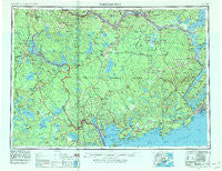
Fredericton, Maine, USGS topographic map dated 1957.
Includes geographic coordinates (latitude and longitude). This topographic map is suitable for hiking, camping, and exploring, or framing it as a wall map.
Printed on-demand using high resolution imagery, on heavy weight and acid free paper, or alternatively on a variety of synthetic materials.
Topos available on paper, Waterproof, Poly, or Tyvek. Usually shipping rolled, unless combined with other folded maps in one order.
- Product Number: USGS-5631193
- Free digital map download (high-resolution, GeoPDF): Fredericton, Maine (file size: 16 MB)
- Map Size: please refer to the dimensions of the GeoPDF map above
- Weight (paper map): ca. 55 grams
- Map Type: POD USGS Topographic Map
- Map Series: HTMC
- Map Verison: Historical
- Cell ID: 68790
- Scan ID: 806705
- Imprint Year: 1981
- Woodland Tint: Yes
- Datum: NAD27
- Map Projection: Transverse Mercator
- Map published by United States Geological Survey
- Map published by United States Army Corps of Engineers
- Map published by United States Army
- Map Language: English
- Scanner Resolution: 508 dpi
- Map Cell Name: Fredericton
- Grid size: 1 X 2 Degree
- Date on map: 1957
- Map Scale: 1:250000
- Geographical region: Maine, United States
Neighboring Maps:
All neighboring USGS topo maps are available for sale online at a variety of scales.
Spatial coverage:
Topo map Fredericton, Maine, covers the geographical area associated the following places:
- Tomah - Bingo - Kelleyland - Lamb Place - West Princeton - North Perry - Charlotte - Forest - Grand Lake Stream - Waite - Red Beach Landing - Codyville - Eaton - Fletcher Field - Blanchard Corner - Danforth - South Robbinston - Brookton - Woodland Junction - Elsemore Landing - Greenlaw Chopping Landing - North Amity - Haynesville - Selden - Lambert Lake - Saint Croix Junction - Forest City Landing - Estabrook Settlement - Butterfield Landing - Milltown - Weston - South Princeton - Gould Landing - South Bancroft - Crawford - Woodland - Baring - Irish Settlement - Princeton - Vanceboro - Peter Dana Point - Bear Trap Landing - North Bancroft - South Amity - Meddybemps - Cary - Calais - Cedar - Robbinston - Alexander - Forest City - Orient - Topsfield - Indian Landing - Red Beach - The Pines - Jumbo Landing - Cropley Turn - Whitlocks Mill - Grove
- Map Area ID: AREA4645-68-66
- Northwest corner Lat/Long code: USGSNW46-68
- Northeast corner Lat/Long code: USGSNE46-66
- Southwest corner Lat/Long code: USGSSW45-68
- Southeast corner Lat/Long code: USGSSE45-66
- Northern map edge Latitude: 46
- Southern map edge Latitude: 45
- Western map edge Longitude: -68
- Eastern map edge Longitude: -66


