
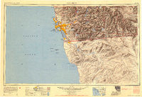
~ San Diego CA topo map, 1:250000 scale, 1 X 2 Degree, Historical, 1954
San Diego, California, USGS topographic map dated 1954.
Includes geographic coordinates (latitude and longitude). This topographic map is suitable for hiking, camping, and exploring, or framing it as a wall map.
Printed on-demand using high resolution imagery, on heavy weight and acid free paper, or alternatively on a variety of synthetic materials.
Topos available on paper, Waterproof, Poly, or Tyvek. Usually shipping rolled, unless combined with other folded maps in one order.
- Product Number: USGS-5631041
- Free digital map download (high-resolution, GeoPDF): San Diego, California (file size: 18 MB)
- Map Size: please refer to the dimensions of the GeoPDF map above
- Weight (paper map): ca. 55 grams
- Map Type: POD USGS Topographic Map
- Map Series: HTMC
- Map Verison: Historical
- Cell ID: 69013
- Scan ID: 707579
- Datum: Unstated
- Map Projection: Transverse Mercator
- Shaded Relief map: Yes
- Map published by United States Army
- Map Language: English
- Scanner Resolution: 508 dpi
- Map Cell Name: San Diego
- Grid size: 1 X 2 Degree
- Date on map: 1954
- Map Scale: 1:250000
- Geographical region: California, United States
Neighboring Maps:
All neighboring USGS topo maps are available for sale online at a variety of scales.
Spatial coverage:
Topo map San Diego, California, covers the geographical area associated the following places:
- Jamul - San Ysidro - Alpine Heights - Eastlake - Harbison Canyon - Tecate - Roseville - Elvira - Chollas Creek - Barona - Bankhead Springs - La Jolla - North Park - Mount Hope - Riverview Farms - South Park - Shelltown - Riverview - Descanso Junction - Pine Grove - Boulevard - La Jolla Hermosa - Rancho del Rey - Lakeview - Eastlake Greens - Dos Cabezas - Lakeside - La Jolla Shores - Clairemont - Hacienda del Florasol - Dulzura - El Cajon - Chollas View - Mortero Palms - Santee - Irvings Crest - Bayside Village - The Woods Trailer Park - South San Diego - Jamacha - Rancho San Diego - Nestor - Coronado - Old Town San Diego - Barrett - Sorrento - Riviera Villas - Five Points - Fort Rosecrans - Normal Heights - South Bay Terraces - Palm Grove - Lincoln Park - The Muirlands - Chula Vista - Jamul Indian Village - La Presa - Mount Helix - Lakeside Farms - Poway - Mission del Magnolia Mobile Home Park - La Cresta - Allied Gardens - Manzanita - Carlton Hills - Highlands Mobile Home Park - Mesquite Oasis - Sherman Heights - Town and Country Mobile Home Park - South Encantato - Mussey Grove (historical) - Lemon Grove - Hillsdale - La Mesa - Bay Park - Fiesta Shores - Valencia Park - University City - University Heights - Hillcrest - Encanto - Bancroft Point - Fernbrook - Winter Gardens - Fleetridge - Bostonia - Glen Oaks - Bonita - Lomita - Alpine - North Jamul - Casa de Oro - Tent City (historical) - Riviera Shores - Imperial Beach - Poway Grove Park - Mount Laguna - Cuyamaca (historical) - Sunset Cliffs - Laguna Junction
- Map Area ID: AREA3332-118-116
- Northwest corner Lat/Long code: USGSNW33-118
- Northeast corner Lat/Long code: USGSNE33-116
- Southwest corner Lat/Long code: USGSSW32-118
- Southeast corner Lat/Long code: USGSSE32-116
- Northern map edge Latitude: 33
- Southern map edge Latitude: 32
- Western map edge Longitude: -118
- Eastern map edge Longitude: -116


