
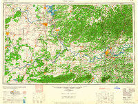
~ Fort Smith OK topo map, 1:250000 scale, 1 X 2 Degree, Historical, 1965, updated 1965
Fort Smith, Oklahoma, USGS topographic map dated 1965.
Includes geographic coordinates (latitude and longitude). This topographic map is suitable for hiking, camping, and exploring, or framing it as a wall map.
Printed on-demand using high resolution imagery, on heavy weight and acid free paper, or alternatively on a variety of synthetic materials.
Topos available on paper, Waterproof, Poly, or Tyvek. Usually shipping rolled, unless combined with other folded maps in one order.
- Product Number: USGS-5630941
- Free digital map download (high-resolution, GeoPDF): Fort Smith, Oklahoma (file size: 14 MB)
- Map Size: please refer to the dimensions of the GeoPDF map above
- Weight (paper map): ca. 55 grams
- Map Type: POD USGS Topographic Map
- Map Series: HTMC
- Map Verison: Historical
- Cell ID: 68785
- Scan ID: 802270
- Imprint Year: 1965
- Woodland Tint: Yes
- Aerial Photo Year: 1946
- Datum: NAD27
- Map Projection: Transverse Mercator
- Map published by United States Army Corps of Engineers
- Map published by United States Army
- Map Language: English
- Scanner Resolution: 508 dpi
- Map Cell Name: Fort Smith
- Grid size: 1 X 2 Degree
- Date on map: 1965
- Map Scale: 1:250000
- Geographical region: Oklahoma, United States
Neighboring Maps:
All neighboring USGS topo maps are available for sale online at a variety of scales.
Spatial coverage:
Topo map Fort Smith, Oklahoma, covers the geographical area associated the following places:
- Belfonte - Abbott - Blackgum - Floss - Barcelona - Flute Springs - Stidham - Piney - Sorrels - Greenwood - Hackett - Woolsey - Eram - Wildcat Point - Okay - Scipio - Sexton (historical) - Crossroads - Walls - Haroldton - Bunch - Summit - Nicut - Hy 10 Landing - Dyer - Spade Mountain - Kibler - Lucas - Hoyt - Going Snake - Massey Point - Kusa - Diamond Grove - Stilwell - Lincoln - Hill - Carters Corner - Muskogee - Brent - Flusche - Blackjack - Liberty - Lenna - Winslow - Council Hill - Sunset - Pumpkin Center - Tahlequah - Dill Place (historical) - Shady Point - Murry Spur - Armada (historical) - Bixby - Crekola - Marble City - Charleston - Cavanaugh - Jenson - Yoestown - Russellville - Gibson - Carlton Landing - White Oak - Massard - Natura - Crescent - Pumpkin Center - Hitchita - Winchester - Clarksville - Mill Creek - Fort Chaffee - Westville - West Fork - Summers - Maple - Tenkiller - Webbers Falls - Brush Hill - Keota - Sanders - Grandview Heights - Woodall - Springhill - Huntington - Midland - Rosedale (historical) - Sallisaw - Mount Gaylor - Briggs - Brundidge - Boothe - Welling - Suttle - Eastgate Place - Taft - Milton - Greenland - Lequire - McKey
- Map Area ID: AREA3635-96-94
- Northwest corner Lat/Long code: USGSNW36-96
- Northeast corner Lat/Long code: USGSNE36-94
- Southwest corner Lat/Long code: USGSSW35-96
- Southeast corner Lat/Long code: USGSSE35-94
- Northern map edge Latitude: 36
- Southern map edge Latitude: 35
- Western map edge Longitude: -96
- Eastern map edge Longitude: -94


