
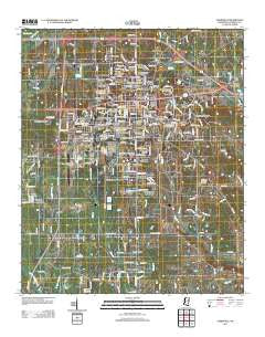
~ Starkville MS topo map, 1:24000 scale, 7.5 X 7.5 Minute, Historical, 2012
Starkville, Mississippi, USGS topographic map dated 2012.
Includes geographic coordinates (latitude and longitude). This topographic map is suitable for hiking, camping, and exploring, or framing it as a wall map.
Printed on-demand using high resolution imagery, on heavy weight and acid free paper, or alternatively on a variety of synthetic materials.
Topos available on paper, Waterproof, Poly, or Tyvek. Usually shipping rolled, unless combined with other folded maps in one order.
- Product Number: USGS-5630225
- Free digital map download (high-resolution, GeoPDF): Starkville, Mississippi (file size: 26 MB)
- Map Size: please refer to the dimensions of the GeoPDF map above
- Weight (paper map): ca. 55 grams
- Map Type: POD USGS Topographic Map
- Map Series: US Topo
- Map Verison: Historical
- Cell ID: 71712
- Datum: North American Datum of 1983
- Map Projection: Transverse Mercator
- Map Cell Name: Starkville
- Grid size: 7.5 X 7.5 Minute
- Date on map: 2012
- Map Scale: 1:24000
- Geographical region: Mississippi, United States
Neighboring Maps:
All neighboring USGS topo maps are available for sale online at a variety of scales.
Spatial coverage:
Topo map Starkville, Mississippi, covers the geographical area associated the following places:
- Country Meadows - Oktibbeha Gardens - Didlake - College Vista - Northwood Hills - Sherwood Forest - Rolling Hills - Northwood - Conner Heights - Sheely Hills - Hillcrest - Country Side Estates - Wood Dale - Starkville - Heritage Colony - Country Club Subdivision - University Estates - Cedar Point - Colonial Hills - University Heights - Wood Manor - Avondale - Quail Valley - Tanglewood - Pleasant Acres - Clayton Village - Plantation Homes - Montgomery Park - Fairground Subdivision - Sunset - Magnolia Heights - Patrick - Bingham Estates - Pressly Place - Rosedale - Westwood - Deerfield - Pecan Acres - Wellborn Subdivision - Landers - Nashdale - Highland Estates - Greenbriar - Timbercove - Country Hills - Stonegate - Parkdale - Fairfield Commons - Glendale - Northgate - Green Oaks - West End - Whispering Pines - Woodland Heights - Cherokee Heights - Page Subdivision - Templeton Meadows - Southdale - Academy Park - Hillbrook - Hancock Circle - College View
- Map Area ID: AREA33.533.375-88.875-88.75
- Northwest corner Lat/Long code: USGSNW33.5-88.875
- Northeast corner Lat/Long code: USGSNE33.5-88.75
- Southwest corner Lat/Long code: USGSSW33.375-88.875
- Southeast corner Lat/Long code: USGSSE33.375-88.75
- Northern map edge Latitude: 33.5
- Southern map edge Latitude: 33.375
- Western map edge Longitude: -88.875
- Eastern map edge Longitude: -88.75


