
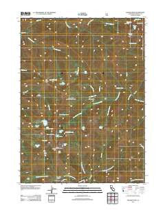
~ English Peak CA topo map, 1:24000 scale, 7.5 X 7.5 Minute, Historical, 2012
English Peak, California, USGS topographic map dated 2012.
Includes geographic coordinates (latitude and longitude). This topographic map is suitable for hiking, camping, and exploring, or framing it as a wall map.
Printed on-demand using high resolution imagery, on heavy weight and acid free paper, or alternatively on a variety of synthetic materials.
Topos available on paper, Waterproof, Poly, or Tyvek. Usually shipping rolled, unless combined with other folded maps in one order.
- Product Number: USGS-5629807
- Free digital map download (high-resolution, GeoPDF): English Peak, California (file size: 24 MB)
- Map Size: please refer to the dimensions of the GeoPDF map above
- Weight (paper map): ca. 55 grams
- Map Type: POD USGS Topographic Map
- Map Series: US Topo
- Map Verison: Historical
- Cell ID: 14401
- Datum: North American Datum of 1983
- Map Projection: Transverse Mercator
- Map Cell Name: English Peak
- Grid size: 7.5 X 7.5 Minute
- Date on map: 2012
- Map Scale: 1:24000
- Geographical region: California, United States
Neighboring Maps:
All neighboring USGS topo maps are available for sale online at a variety of scales.
Spatial coverage:
Topo map English Peak, California, covers the geographical area associated the following places:
- Big Meadows - Big Meadows Creek - Grants Meadows - Upper English Lake - Snowslide Gulch - Horse Range Lake - Wooley Lake - Blueberry Lake - Charmaine Lake - Deer Lick Creek - Cold Springs Creek - Right Hand Fork Uncles Creek - Dollar Creek - Lake of the Island - Grant Creek - Pierces Draw - Lake of the Island Creek - Abbott Lake - English Peak Lookout Tower - Wild Lake - Tobacco Lake - Lake Katherine - Heather Lake - Smith Cabin - Hell Hole Ridge - Sick Doe Gulch - Devils Canyon - Lake Ethel - Milne Lake - Little Hancock Lake - Diamond Lake - Hancock Lake - Toms Lake - Crystal Clear Creek - Pine Lake - Marble Mountain Wilderness - English Peak - Left Hand Fork Uncles Creek - Snowslide Gulch - Uncles Creek - Tom Taylor Cabin - Dry Lake - Uncles Lake - Herr Creek - Osprey Lake - Boulder Creek - English Lake - Abbotts Upper Cabin
- Map Area ID: AREA41.541.375-123.25-123.125
- Northwest corner Lat/Long code: USGSNW41.5-123.25
- Northeast corner Lat/Long code: USGSNE41.5-123.125
- Southwest corner Lat/Long code: USGSSW41.375-123.25
- Southeast corner Lat/Long code: USGSSE41.375-123.125
- Northern map edge Latitude: 41.5
- Southern map edge Latitude: 41.375
- Western map edge Longitude: -123.25
- Eastern map edge Longitude: -123.125


