
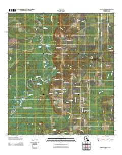
~ Shoats Creek LA topo map, 1:24000 scale, 7.5 X 7.5 Minute, Historical, 2012
Shoats Creek, Louisiana, USGS topographic map dated 2012.
Includes geographic coordinates (latitude and longitude). This topographic map is suitable for hiking, camping, and exploring, or framing it as a wall map.
Printed on-demand using high resolution imagery, on heavy weight and acid free paper, or alternatively on a variety of synthetic materials.
Topos available on paper, Waterproof, Poly, or Tyvek. Usually shipping rolled, unless combined with other folded maps in one order.
- Product Number: USGS-5628998
- Free digital map download (high-resolution, GeoPDF): Shoats Creek, Louisiana (file size: 27 MB)
- Map Size: please refer to the dimensions of the GeoPDF map above
- Weight (paper map): ca. 55 grams
- Map Type: POD USGS Topographic Map
- Map Series: US Topo
- Map Verison: Historical
- Cell ID: 41147
- Datum: North American Datum of 1983
- Map Projection: Transverse Mercator
- Map Cell Name: Shoats Creek
- Grid size: 7.5 X 7.5 Minute
- Date on map: 2012
- Map Scale: 1:24000
- Geographical region: Louisiana, United States
Neighboring Maps:
All neighboring USGS topo maps are available for sale online at a variety of scales.
Spatial coverage:
Topo map Shoats Creek, Louisiana, covers the geographical area associated the following places:
- Horseshoe Lake - Little Eddy Lake - Hurricane Creek - Nicks Ferry (historical) - Beckam Lake - Smith Cemetery - Bayou Deception Island - Devils Pocket - Little River Lake - Gambrell Baptist Church - Circle Lake - Clark Cemetery - Alligator Lake - High Hill - Big Eddy Lake - Slaydons Slough - Morgan Lake - Duetts Eddy Lake - Shoats Creek - Carter Cemetery - Burnt Stump Lake - South Bancroft Gas Field - Nicks Landing - Alligator Slough - Cauley Lake - Clark Cemetery - Clear Lake - Boggy Lake - Dead Lake - North Starks Oil Field - Boggy Lakes - Slaydons Creek - Carter Creek - Green Island Marsh Creek
- Map Area ID: AREA30.530.375-93.75-93.625
- Northwest corner Lat/Long code: USGSNW30.5-93.75
- Northeast corner Lat/Long code: USGSNE30.5-93.625
- Southwest corner Lat/Long code: USGSSW30.375-93.75
- Southeast corner Lat/Long code: USGSSE30.375-93.625
- Northern map edge Latitude: 30.5
- Southern map edge Latitude: 30.375
- Western map edge Longitude: -93.75
- Eastern map edge Longitude: -93.625


