
~ Yankeetown SE FL topo map, 1:24000 scale, 7.5 X 7.5 Minute, Historical, 1954, updated 1961
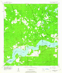
Yankeetown SE, Florida, USGS topographic map dated 1954.
Includes geographic coordinates (latitude and longitude). This topographic map is suitable for hiking, camping, and exploring, or framing it as a wall map.
Printed on-demand using high resolution imagery, on heavy weight and acid free paper, or alternatively on a variety of synthetic materials.
Topos available on paper, Waterproof, Poly, or Tyvek. Usually shipping rolled, unless combined with other folded maps in one order.
- Product Number: USGS-5628942
- Free digital map download (high-resolution, GeoPDF): Yankeetown SE, Florida (file size: 11 MB)
- Map Size: please refer to the dimensions of the GeoPDF map above
- Weight (paper map): ca. 55 grams
- Map Type: POD USGS Topographic Map
- Map Series: HTMC
- Map Verison: Historical
- Cell ID: 50038
- Scan ID: 349176
- Imprint Year: 1961
- Woodland Tint: Yes
- Aerial Photo Year: 1951
- Survey Year: 1954
- Datum: NAD27
- Map Projection: Polyconic
- Map published by United States Geological Survey
- Map Language: English
- Scanner Resolution: 600 dpi
- Map Cell Name: Yankeetown SE
- Grid size: 7.5 X 7.5 Minute
- Date on map: 1954
- Map Scale: 1:24000
- Geographical region: Florida, United States
Neighboring Maps:
All neighboring USGS topo maps are available for sale online at a variety of scales.
Spatial coverage:
Topo map Yankeetown SE, Florida, covers the geographical area associated the following places:
- Blackwater Lake - J.R.'s Airport - Red Level Substation Number 1 - Turner Creek - Citrus County Fire Rescue Station 9 - Hellcat Bay - Cedar of Lebanon Cemetery - Little Cedar Hammock - Little Clearwater Lake - Lindsey Lake - Bear Hammock - Inglis Dam - Bream Lake - Crystal Manor - Robinson Cemetery - South Levy Volunteer Fire Station - District 1 - Long Pond - Salt Sick Lake - Dog Ear Cemetery - Bell Branch - Jumper Lake - Big Bay - Buck Lake - Clearwater Lake - Bell Pond - Little Bream Lake - Bear Hammock Lake - Little Bay Lake - Inglis Lock - Dog Ear Lake - Lake Rousseau - Cedar Hammock - Big Bay Lake
- Map Area ID: AREA29.12529-82.625-82.5
- Northwest corner Lat/Long code: USGSNW29.125-82.625
- Northeast corner Lat/Long code: USGSNE29.125-82.5
- Southwest corner Lat/Long code: USGSSW29-82.625
- Southeast corner Lat/Long code: USGSSE29-82.5
- Northern map edge Latitude: 29.125
- Southern map edge Latitude: 29
- Western map edge Longitude: -82.625
- Eastern map edge Longitude: -82.5


