
~ Wesley Chapel FL topo map, 1:24000 scale, 7.5 X 7.5 Minute, Historical, 1944, updated 1961
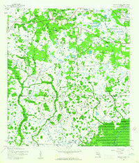
Wesley Chapel, Florida, USGS topographic map dated 1944.
Includes geographic coordinates (latitude and longitude). This topographic map is suitable for hiking, camping, and exploring, or framing it as a wall map.
Printed on-demand using high resolution imagery, on heavy weight and acid free paper, or alternatively on a variety of synthetic materials.
Topos available on paper, Waterproof, Poly, or Tyvek. Usually shipping rolled, unless combined with other folded maps in one order.
- Product Number: USGS-5628762
- Free digital map download (high-resolution, GeoPDF): Wesley Chapel, Florida (file size: 9 MB)
- Map Size: please refer to the dimensions of the GeoPDF map above
- Weight (paper map): ca. 55 grams
- Map Type: POD USGS Topographic Map
- Map Series: HTMC
- Map Verison: Historical
- Cell ID: 48110
- Scan ID: 349030
- Imprint Year: 1961
- Woodland Tint: Yes
- Aerial Photo Year: 1942
- Survey Year: 1944
- Datum: NAD27
- Map Projection: Polyconic
- Map published by United States Geological Survey
- Map Language: English
- Scanner Resolution: 600 dpi
- Map Cell Name: Wesley Chapel
- Grid size: 7.5 X 7.5 Minute
- Date on map: 1944
- Map Scale: 1:24000
- Geographical region: Florida, United States
Neighboring Maps:
All neighboring USGS topo maps are available for sale online at a variety of scales.
Spatial coverage:
Topo map Wesley Chapel, Florida, covers the geographical area associated the following places:
- Dukes Natures Acres - Trout Creek Commons - Big Daddy Estates - Clubview - Cross Creek Substation - Heritage Isles - Cedar Cove - North Oakcrest - Lakeview Villas at Pebble Creek Village - Highwoods Preserve - Pebble Creek - Magnolia Chase - Cory Lake Isles - Fox Chase - Wesley Chapel - Club Manor East of Grand Hampton - Del Prado - Arbor Greene - Cross Creek Gardens - Pebble Creek Village - Branchton - Wilderness Crossings - Richmond Place - Lake Pointe - Hammocks - Wynstone - Stone Ridge at Highwoods Preserve - Cross Creek - Cornerstone Ranch - Hunters Green - Live Oak Preserve
- Map Area ID: AREA28.2528.125-82.375-82.25
- Northwest corner Lat/Long code: USGSNW28.25-82.375
- Northeast corner Lat/Long code: USGSNE28.25-82.25
- Southwest corner Lat/Long code: USGSSW28.125-82.375
- Southeast corner Lat/Long code: USGSSE28.125-82.25
- Northern map edge Latitude: 28.25
- Southern map edge Latitude: 28.125
- Western map edge Longitude: -82.375
- Eastern map edge Longitude: -82.25


