
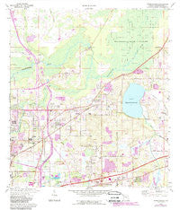
~ Thonotosassa FL topo map, 1:24000 scale, 7.5 X 7.5 Minute, Historical, 1974, updated 1988
Thonotosassa, Florida, USGS topographic map dated 1974.
Includes geographic coordinates (latitude and longitude). This topographic map is suitable for hiking, camping, and exploring, or framing it as a wall map.
Printed on-demand using high resolution imagery, on heavy weight and acid free paper, or alternatively on a variety of synthetic materials.
Topos available on paper, Waterproof, Poly, or Tyvek. Usually shipping rolled, unless combined with other folded maps in one order.
- Product Number: USGS-5628458
- Free digital map download (high-resolution, GeoPDF): Thonotosassa, Florida (file size: 12 MB)
- Map Size: please refer to the dimensions of the GeoPDF map above
- Weight (paper map): ca. 55 grams
- Map Type: POD USGS Topographic Map
- Map Series: HTMC
- Map Verison: Historical
- Cell ID: 44925
- Scan ID: 348851
- Imprint Year: 1988
- Woodland Tint: Yes
- Photo Revision Year: 1987
- Aerial Photo Year: 1984
- Edit Year: 1987
- Field Check Year: 1974
- Datum: NAD27
- Map Projection: Transverse Mercator
- Map published by United States Geological Survey
- Map Language: English
- Scanner Resolution: 600 dpi
- Map Cell Name: Thonotosassa
- Grid size: 7.5 X 7.5 Minute
- Date on map: 1974
- Map Scale: 1:24000
- Geographical region: Florida, United States
Neighboring Maps:
All neighboring USGS topo maps are available for sale online at a variety of scales.
Spatial coverage:
Topo map Thonotosassa, Florida, covers the geographical area associated the following places:
- Silver Oaks - Badgers Lair - Hazen Court - Rustic Village - Caryn Place - Stonelake Ranch - Trifoliata - Pilgrims Place - Riveredge - River Run - Eastern Terrace Estates - Preserve at Fletcher Avenue - Country Road Acres - Clewis Muck Farms - Rolling Terrace - McIntosh Oaks - Holley Heights - Tangelo Terrace Estates - Temple Estates - Gilfort - Kings Row - Darby Lake - Northwoods - Rosa Woods - Barbers Lakeview - Sterling Heights - The Woodlands - Efird Farms - Magnolia Manors - Muck Pond Farms - Hickory Lakes Manor - Oak Dale Heights - Davis Terrace - Farabee Acres - Thonotosassa - Clewis Garden - Thousand Oaks - Serenity Oaks - The Arbors at Fletcher Island - Arrowhead Estates - Rolling Terrace Run - Gilmore Manor - Shangri La - June Bloom - Pinker East - Harney Gardens - Jefferson Heights - Sasnett Estates - Primrose Gardens - Orange River Estates - Tampa Oaks - Woodland Park Acres - Dunwoodie Park - Clark - Lago Whispers - Cousins Corner - Harris Landings - Terrace Highlands - Meadowood Village - Andrews - Hampton on the Green - Temple Hills - Temple Terrace Junction - Winners Circle - Meisels - Timmons Estates - Martello Heights - Temple Terrace Woods - Toulon - Ye Little Wood - Heather Downs - Terrace River - Gentilly Oaks - Meadowood Oaks - Vista del Rio - Rhodes - The Depot - Jolly Corner - Phillips - Straits - Oak Forest - Bridgeford Oaks - Deer Run Estates - Sam Mills - Williams Road Mobile Villa - Lanrite - Magnolia Mobile Manor - Temple Oaks - Kalebs Forest - Skewlee Gardens - Mingo Manor - Kennedy Hill - Suns Acres - College Park East - Bella Farms - Pemberton Creek - Breckenridge Park - Virginia Lee Estates - American Gardens - Flint Lake
- Map Area ID: AREA28.12528-82.375-82.25
- Northwest corner Lat/Long code: USGSNW28.125-82.375
- Northeast corner Lat/Long code: USGSNE28.125-82.25
- Southwest corner Lat/Long code: USGSSW28-82.375
- Southeast corner Lat/Long code: USGSSE28-82.25
- Northern map edge Latitude: 28.125
- Southern map edge Latitude: 28
- Western map edge Longitude: -82.375
- Eastern map edge Longitude: -82.25


