
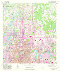
~ Sulphur Springs FL topo map, 1:24000 scale, 7.5 X 7.5 Minute, Historical, 1956, updated 1982
Sulphur Springs, Florida, USGS topographic map dated 1956.
Includes geographic coordinates (latitude and longitude). This topographic map is suitable for hiking, camping, and exploring, or framing it as a wall map.
Printed on-demand using high resolution imagery, on heavy weight and acid free paper, or alternatively on a variety of synthetic materials.
Topos available on paper, Waterproof, Poly, or Tyvek. Usually shipping rolled, unless combined with other folded maps in one order.
- Product Number: USGS-5628306
- Free digital map download (high-resolution, GeoPDF): Sulphur Springs, Florida (file size: 15 MB)
- Map Size: please refer to the dimensions of the GeoPDF map above
- Weight (paper map): ca. 55 grams
- Map Type: POD USGS Topographic Map
- Map Series: HTMC
- Map Verison: Historical
- Cell ID: 43701
- Scan ID: 348729
- Imprint Year: 1982
- Woodland Tint: Yes
- Photo Revision Year: 1981
- Aerial Photo Year: 1977
- Edit Year: 1981
- Survey Year: 1956
- Datum: NAD27
- Map Projection: Polyconic
- Map published by United States Geological Survey
- Map Language: English
- Scanner Resolution: 600 dpi
- Map Cell Name: Sulphur Springs
- Grid size: 7.5 X 7.5 Minute
- Date on map: 1956
- Map Scale: 1:24000
- Geographical region: Florida, United States
Neighboring Maps:
All neighboring USGS topo maps are available for sale online at a variety of scales.
Spatial coverage:
Topo map Sulphur Springs, Florida, covers the geographical area associated the following places:
- Laurel Terrace - River Crest Estates - Ranchester - Lake Egypt Estates - Lake Gass Estates - Georgia Terrace - Daneli North - The Villas at University Village - Lorraine Estates - Wilma - Bungalow Park - Emerald Cove - Tiffany Lake Manors - Sonoma Heights - Burrell Estates - Dill - Jones Estates - Raintree Terrace - Hill Top Heights - Manor Heights - Cherry Creek - Temple Braska - Bougainvillea Oaks - Vista Ridge - Green Meadow - Coarsey Grove Estates - McCary - Knollwood Estates - Ridgeland Ranch - Grovewood Court - Maffett - Lake Ellen Shores - Silver Forrest - Dixie Terrace - Tarawood - Puritan Heights - Crestmont - Vine Park - North Park - Cotters Spring Hill - The Manors of Nottingham - Tuxedo Springs - Country Club Place - Pond Eddy - Linebaugh Avenue Estates - Riverbend - Variety Grove Estates - Temple Bluff - Takomah Trail - Cypress Head - Lake Forest - Nowatney - Vandervort Acres - Lake View Heights - Auburn Highlands - Fletchers Mill - Walkers Ranch Estates - El Portal - Kimberly Lane - Magdalene Grove - Little Eleven - Watrous Gardens - Golden - Temple Terrace - The Springs - Idle Grove Park - Springoak - Temple Knoll - Grove Park Estates - Wolfson - Julian Estates - Daphne Park - Woodfield River Oaks - Croteau - Paddock Square - Claonia Highlands - Chapman - Tampa Overlook - Susan Marie Terrace - Clewell Heights - River Manor - Lake Ellen Grove - Lake Ellen Walk - Pleasant Estates - Azure Estates - Ritch Acres - Meadows Estates - Clifton Park - Healthy Hill - Banner Oaks - Temple Heights - Wil Jo - Whisper Cove - James E Ferrari Estates - The Oaks at Busch - Tilsen Manor - Sulphur Springs - Kay Wood Heights - The Arbors - Jenny Lyne Estates
- Map Area ID: AREA28.12528-82.5-82.375
- Northwest corner Lat/Long code: USGSNW28.125-82.5
- Northeast corner Lat/Long code: USGSNE28.125-82.375
- Southwest corner Lat/Long code: USGSSW28-82.5
- Southeast corner Lat/Long code: USGSSE28-82.375
- Northern map edge Latitude: 28.125
- Southern map edge Latitude: 28
- Western map edge Longitude: -82.5
- Eastern map edge Longitude: -82.375


