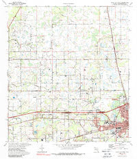
~ Plant City West FL topo map, 1:24000 scale, 7.5 X 7.5 Minute, Historical, 1975, updated 1988
Plant City West, Florida, USGS topographic map dated 1975.
Includes geographic coordinates (latitude and longitude). This topographic map is suitable for hiking, camping, and exploring, or framing it as a wall map.
Printed on-demand using high resolution imagery, on heavy weight and acid free paper, or alternatively on a variety of synthetic materials.
Topos available on paper, Waterproof, Poly, or Tyvek. Usually shipping rolled, unless combined with other folded maps in one order.
- Product Number: USGS-5627320
- Free digital map download (high-resolution, GeoPDF): Plant City West, Florida (file size: 11 MB)
- Map Size: please refer to the dimensions of the GeoPDF map above
- Weight (paper map): ca. 55 grams
- Map Type: POD USGS Topographic Map
- Map Series: HTMC
- Map Verison: Historical
- Cell ID: 35570
- Scan ID: 348134
- Imprint Year: 1988
- Woodland Tint: Yes
- Photo Inspection Year: 1983
- Aerial Photo Year: 1971
- Field Check Year: 1975
- Datum: NAD27
- Map Projection: Transverse Mercator
- Map published by United States Geological Survey
- Map Language: English
- Scanner Resolution: 600 dpi
- Map Cell Name: Plant City West
- Grid size: 7.5 X 7.5 Minute
- Date on map: 1975
- Map Scale: 1:24000
- Geographical region: Florida, United States
Neighboring Maps:
All neighboring USGS topo maps are available for sale online at a variety of scales.
Spatial coverage:
Topo map Plant City West, Florida, covers the geographical area associated the following places:
- Leaning Pine - Carylwood - Family Ranch - Bartons Country Estates - Hartline - Destinys Way - Forest Oak - Kinard Estates - Burchwood - Eurcelles - Miley Trace - Strickland - Dormany Oaks - West Pinecrest - Todd Acres - Godins Golden Acres - Green Valley - Highland Pines Estates - New Hope - Browning Acres - Country Trails - Long Fritzke - McIntosh Country Acres - Green Pastures - Gaineys Acres - Knights - Pondside Gardens - Island Pond Estates - Franklin Woodlands - Stallwood - Aldermans Addition - Sunset Heights - Greenleaf - Antioch Place - Mayo Acres - Sunny Slopes - Reeves Estate - Gough Pless Estates - Little Bit Manor - Pine Ridge - Strawberry Square - Snows Corner - Renaissance Estates - Herndons Mill - Morgan Minor - Dormany Country Estates - Seminole Lake Estates - Cedar Run - Reynolds Ridge - Cox Acres - Moores Lake Grove - Arbor Acres - Marcia Oaks - Riverleaf - Fritzke Acres - Dover Groves - Piergallini - Cypress Reserve - Krause Farms - Rustic Oaks Plantation - Jerkins Acres - Webb Ranch Acres - McElveen - Saylor Estates - Boone Acres - Oakland Heights - Cooks Cove - Oak Park Heights - Clover Pointe Estates - Kingston City - Forbes Acres - Helen Winter Gardens - Bennett Acres - Dilports - Svensson - Keene Country Acres - Sparkman Heights - Sam Allen Oaks - Madison Park - San Juan Acres - Schiffers Acres - Strawberry Village - Cooper Hollow - Gator Trail - Campbells Cove - Kenny - All Green - Singletary - Herndon Estates - Robart Acres - Morningside Heights - Keene - Julieann Acres - Dickey - Key Woods Ranch - Antioch - McIntosh Estates West - Blain Acres - Franklin Creek Estates - Poinsettia Place
- Map Area ID: AREA28.12528-82.25-82.125
- Northwest corner Lat/Long code: USGSNW28.125-82.25
- Northeast corner Lat/Long code: USGSNE28.125-82.125
- Southwest corner Lat/Long code: USGSSW28-82.25
- Southeast corner Lat/Long code: USGSSE28-82.125
- Northern map edge Latitude: 28.125
- Southern map edge Latitude: 28
- Western map edge Longitude: -82.25
- Eastern map edge Longitude: -82.125

