
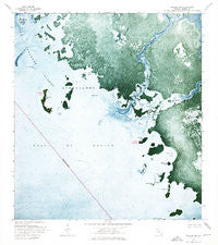
~ Pavilion Key FL topo map, 1:24000 scale, 7.5 X 7.5 Minute, Historical, 1973, updated 1976
Pavilion Key, Florida, USGS topographic map dated 1973.
Includes geographic coordinates (latitude and longitude). This topographic map is suitable for hiking, camping, and exploring, or framing it as a wall map.
Printed on-demand using high resolution imagery, on heavy weight and acid free paper, or alternatively on a variety of synthetic materials.
Topos available on paper, Waterproof, Poly, or Tyvek. Usually shipping rolled, unless combined with other folded maps in one order.
- Product Number: USGS-5627172
- Free digital map download (high-resolution, GeoPDF): Pavilion Key, Florida (file size: 17 MB)
- Map Size: please refer to the dimensions of the GeoPDF map above
- Weight (paper map): ca. 55 grams
- Map Type: POD USGS Topographic Map
- Map Series: HTMC
- Map Verison: Historical
- Cell ID: 34451
- Scan ID: 348034
- Imprint Year: 1976
- Woodland Tint: Yes
- Aerial Photo Year: 1971
- Survey Year: 1973
- Datum: NAD27
- Map Projection: Transverse Mercator
- Orthophoto: Map
- Map published by United States Geological Survey
- Map Language: English
- Scanner Resolution: 600 dpi
- Map Cell Name: Pavilion Key
- Grid size: 7.5 X 7.5 Minute
- Date on map: 1973
- Map Scale: 1:24000
- Geographical region: Florida, United States
Neighboring Maps:
All neighboring USGS topo maps are available for sale online at a variety of scales.
Spatial coverage:
Topo map Pavilion Key, Florida, covers the geographical area associated the following places:
- Chatham River - Mormon Key - Mosquito Key - Crab Key Bight - Huston River - Buzzard Key - Snake Key - Joe Kemp Key - Turkey Key - New Turkey Key - Duck Rock Cove - Pavilion Key Light 10 - Gun Rock Point - Charley Creek - Storter Bay - Chatham Bend - Clam Point - Crate Key - Pavilion Key - Duck Rock - Huston Cove - Dog Key - Little Pavilion Key
- Map Area ID: AREA25.7525.625-81.375-81.25
- Northwest corner Lat/Long code: USGSNW25.75-81.375
- Northeast corner Lat/Long code: USGSNE25.75-81.25
- Southwest corner Lat/Long code: USGSSW25.625-81.375
- Southeast corner Lat/Long code: USGSSE25.625-81.25
- Northern map edge Latitude: 25.75
- Southern map edge Latitude: 25.625
- Western map edge Longitude: -81.375
- Eastern map edge Longitude: -81.25


