
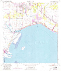
~ Okeechobee FL topo map, 1:24000 scale, 7.5 X 7.5 Minute, Historical, 1952, updated 1973
Okeechobee, Florida, USGS topographic map dated 1952.
Includes geographic coordinates (latitude and longitude). This topographic map is suitable for hiking, camping, and exploring, or framing it as a wall map.
Printed on-demand using high resolution imagery, on heavy weight and acid free paper, or alternatively on a variety of synthetic materials.
Topos available on paper, Waterproof, Poly, or Tyvek. Usually shipping rolled, unless combined with other folded maps in one order.
- Product Number: USGS-5626798
- Free digital map download (high-resolution, GeoPDF): Okeechobee, Florida (file size: 14 MB)
- Map Size: please refer to the dimensions of the GeoPDF map above
- Weight (paper map): ca. 55 grams
- Map Type: POD USGS Topographic Map
- Map Series: HTMC
- Map Verison: Historical
- Cell ID: 33017
- Scan ID: 347758
- Imprint Year: 1973
- Woodland Tint: Yes
- Photo Revision Year: 1972
- Aerial Photo Year: 1972
- Field Check Year: 1952
- Survey Year: 1951
- Datum: NAD27
- Map Projection: Polyconic
- Map published by United States Geological Survey
- Map published by United States Army Corps of Engineers
- Map Language: English
- Scanner Resolution: 600 dpi
- Map Cell Name: Okeechobee
- Grid size: 7.5 X 7.5 Minute
- Date on map: 1952
- Map Scale: 1:24000
- Geographical region: Florida, United States
Neighboring Maps:
All neighboring USGS topo maps are available for sale online at a variety of scales.
Spatial coverage:
Topo map Okeechobee, Florida, covers the geographical area associated the following places:
- Florida Palm Mobile Park - Seminole Village Mobile Home Park - Emily Park Mobile Home Park - Gator Park Mobile Home Park - Jacobs Trailer Park - Journey End Mobile Home Park - Casablanca Mobile Home Park - Jims Place Mobile Home Park - River Bend Mobile Home Park - Sherman - Georges Lucky Seven Mobile Home Park Number 1 - Whispering Cove Mobile Home Park - Hebel Acres Mobile Home Park - Okeechobee - Vantage Oaks Mobile Home Park - Chapman Trailer Park - Lighthouse Park Mobile Home Park - Taylor Creek Lodge Mobile Home Park - La Fiesta Trailer Park - Town and Country Mobile Home Park - Four Acres Mobile Home Park - Twin Palms Mobile Home Park - Lone Oak Mobile Home Park - Johnsons Trailer Park - Shady Oaks Mobile Home Park - Stephen's Winter Resort Mobile Home Park - Mayberry's Mobile Home Park - Globe Mobile Home Park - S and K Mobile Home Park - J and W Trailer Park - Taylor Creek
- Map Area ID: AREA27.2527.125-80.875-80.75
- Northwest corner Lat/Long code: USGSNW27.25-80.875
- Northeast corner Lat/Long code: USGSNE27.25-80.75
- Southwest corner Lat/Long code: USGSSW27.125-80.875
- Southeast corner Lat/Long code: USGSSE27.125-80.75
- Northern map edge Latitude: 27.25
- Southern map edge Latitude: 27.125
- Western map edge Longitude: -80.875
- Eastern map edge Longitude: -80.75


