
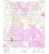
~ Mulberry FL topo map, 1:24000 scale, 7.5 X 7.5 Minute, Historical, 1949, updated 1993
Mulberry, Florida, USGS topographic map dated 1949.
Includes geographic coordinates (latitude and longitude). This topographic map is suitable for hiking, camping, and exploring, or framing it as a wall map.
Printed on-demand using high resolution imagery, on heavy weight and acid free paper, or alternatively on a variety of synthetic materials.
Topos available on paper, Waterproof, Poly, or Tyvek. Usually shipping rolled, unless combined with other folded maps in one order.
- Product Number: USGS-5626454
- Free digital map download (high-resolution, GeoPDF): Mulberry, Florida (file size: 16 MB)
- Map Size: please refer to the dimensions of the GeoPDF map above
- Weight (paper map): ca. 55 grams
- Map Type: POD USGS Topographic Map
- Map Series: HTMC
- Map Verison: Historical
- Cell ID: 31048
- Scan ID: 347559
- Imprint Year: 1993
- Woodland Tint: Yes
- Photo Revision Year: 1987
- Aerial Photo Year: 1984
- Edit Year: 1987
- Survey Year: 1949
- Datum: NAD27
- Map Projection: Transverse Mercator
- Map published by United States Geological Survey
- Map Language: English
- Scanner Resolution: 600 dpi
- Map Cell Name: Mulberry
- Grid size: 7.5 X 7.5 Minute
- Date on map: 1949
- Map Scale: 1:24000
- Geographical region: Florida, United States
Neighboring Maps:
All neighboring USGS topo maps are available for sale online at a variety of scales.
Spatial coverage:
Topo map Mulberry, Florida, covers the geographical area associated the following places:
- Highland Village Mobile Home Park - Medulla - Sanlan Ranch Mobile Home Park - South Mulberry - Tancrede - Anglers Green Mobile Home Park - Lake Pointe Village Mobile Home Park - Twin Lakes Mobile Home Park - Highland Pines Mobile Home Park - Fountain Heights - Mulberry - East Mulberry - Ridgewood - Paradise Lakes Mobile Home Park - Prairie Junction - Royster - Ewell - Fuller Heights - Lakeland Highlands - Highland City - Kingsford - Countryside Mobile Home Park
- Map Area ID: AREA2827.875-82-81.875
- Northwest corner Lat/Long code: USGSNW28-82
- Northeast corner Lat/Long code: USGSNE28-81.875
- Southwest corner Lat/Long code: USGSSW27.875-82
- Southeast corner Lat/Long code: USGSSE27.875-81.875
- Northern map edge Latitude: 28
- Southern map edge Latitude: 27.875
- Western map edge Longitude: -82
- Eastern map edge Longitude: -81.875


