
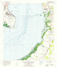
~ Gibsonton FL topo map, 1:24000 scale, 7.5 X 7.5 Minute, Historical, 1956, updated 1957
Gibsonton, Florida, USGS topographic map dated 1956.
Includes geographic coordinates (latitude and longitude). This topographic map is suitable for hiking, camping, and exploring, or framing it as a wall map.
Printed on-demand using high resolution imagery, on heavy weight and acid free paper, or alternatively on a variety of synthetic materials.
Topos available on paper, Waterproof, Poly, or Tyvek. Usually shipping rolled, unless combined with other folded maps in one order.
- Product Number: USGS-5624582
- Free digital map download (high-resolution, GeoPDF): Gibsonton, Florida (file size: 8 MB)
- Map Size: please refer to the dimensions of the GeoPDF map above
- Weight (paper map): ca. 55 grams
- Map Type: POD USGS Topographic Map
- Map Series: HTMC
- Map Verison: Historical
- Cell ID: 17179
- Scan ID: 346431
- Imprint Year: 1957
- Woodland Tint: Yes
- Aerial Photo Year: 1954
- Survey Year: 1956
- Datum: NAD27
- Map Projection: Polyconic
- Map published by United States Geological Survey
- Map Language: English
- Scanner Resolution: 600 dpi
- Map Cell Name: Gibsonton
- Grid size: 7.5 X 7.5 Minute
- Date on map: 1956
- Map Scale: 1:24000
- Geographical region: Florida, United States
Neighboring Maps:
All neighboring USGS topo maps are available for sale online at a variety of scales.
Spatial coverage:
Topo map Gibsonton, Florida, covers the geographical area associated the following places:
- Van Eyck - Remlap - Apollo Key Village - The Estates at Bayshore Pointe - Tropical Pines - Leen - Treviso - Dolphin Cove - Apollo Beach - Magnolia Trails - Bayshore Reserve - Lagomar - Cobia Cay - Adamsville - Gardenville - Surfside Estates by the Bay - McQueens Village (historical) - Marquard Manor - Alafia - Marina Village - Andalucia - East Tampa - Gibsonton on the Bay - Surfside Estates - Edgewater Village - MacKinlay Terrace - Roslyn Heights - Garden City - Island Cay - Mustique Bay - Shagos Bay - Allendale Acres - Golf and Sea Village - Brandwood - Mirabay - Fosterville - Southshore Falls - Allens - Bella Mar - Northpointe at Bayshore - Bindshedler - Island Walk - Bimini Bay - Symphony Isles - Flat Island - Old Bayshore Point - Meadowlawn - Pocket 84 - Beach Club Estates - The Villas at Andalucia - Lookout Place - Bay Vista - Symmes Manor - Villa Di Treviso - Gibsonton - Bayhaven - North Ruskin - Capital Tampa - Peninsula Heights - The Southpointe at Bayshore - MacDill Estates
- Map Area ID: AREA27.87527.75-82.5-82.375
- Northwest corner Lat/Long code: USGSNW27.875-82.5
- Northeast corner Lat/Long code: USGSNE27.875-82.375
- Southwest corner Lat/Long code: USGSSW27.75-82.5
- Southeast corner Lat/Long code: USGSSE27.75-82.375
- Northern map edge Latitude: 27.875
- Southern map edge Latitude: 27.75
- Western map edge Longitude: -82.5
- Eastern map edge Longitude: -82.375


