
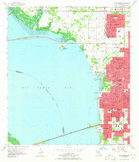
~ Gandy Bridge FL topo map, 1:24000 scale, 7.5 X 7.5 Minute, Historical, 1956, updated 1965
Gandy Bridge, Florida, USGS topographic map dated 1956.
Includes geographic coordinates (latitude and longitude). This topographic map is suitable for hiking, camping, and exploring, or framing it as a wall map.
Printed on-demand using high resolution imagery, on heavy weight and acid free paper, or alternatively on a variety of synthetic materials.
Topos available on paper, Waterproof, Poly, or Tyvek. Usually shipping rolled, unless combined with other folded maps in one order.
- Product Number: USGS-5624510
- Free digital map download (high-resolution, GeoPDF): Gandy Bridge, Florida (file size: 8 MB)
- Map Size: please refer to the dimensions of the GeoPDF map above
- Weight (paper map): ca. 55 grams
- Map Type: POD USGS Topographic Map
- Map Series: HTMC
- Map Verison: Historical
- Cell ID: 16751
- Scan ID: 346393
- Imprint Year: 1965
- Woodland Tint: Yes
- Aerial Photo Year: 1955
- Survey Year: 1956
- Datum: NAD27
- Map Projection: Polyconic
- Map published by United States Geological Survey
- Map Language: English
- Scanner Resolution: 600 dpi
- Map Cell Name: Gandy Bridge
- Grid size: 7.5 X 7.5 Minute
- Date on map: 1956
- Map Scale: 1:24000
- Geographical region: Florida, United States
Neighboring Maps:
All neighboring USGS topo maps are available for sale online at a variety of scales.
Spatial coverage:
Topo map Gandy Bridge, Florida, covers the geographical area associated the following places:
- Elenor Place - Parkdale - Culbreath Isles - Woodward - Picadilly - Bon Air West - Bayport Village - Gandy Boulevard Park - Blackburn - Barbara Lane - East View - Deuber Place - Chateau Villa - Omar - Rosedale - School View Estates - Bayside West - Gandy Gardens - Stoney Point - Crowder - Paradise - Venetian Shores - Waterford on the Bay - Stephanie Way - Gardenia - Silvan - El Prado Gardens - Ownby - Chandler - West Shore Place - North Bon Air - Boyles - Stewart - Saint Clear Place - Treasure Park - Keystone Homes - The Borghese Villas at Westshore - Belvedere Park - Sweetwater Estates - Temple Square - Gray Terrace - Krentel Park - Cornerstone Plaza - Live Oak Place - White Estates - Keats - Forest Park - Gandy Manor - Tampania - Weiland - Arlene Manor - Beans - Beach Park Isles - Manhattan Manor - Westshore Estates South - Sunset Park - Bridgeview Estates - Manhattan Terrace - Bayshore Estates - Sterling - Norma Park - Morrison Court - Rainbow Court - Sunset Park Isles - Seldomridge - Golf View Estates - Henderson Beach - Rocky Creek Estates - The Reserve of Old Tampa Bay - Henderson Place - Wood Grove - Bel Mar Shores - Barnelia - Anadell - Roberts - Belvedere Acres - Azalea Terrace - Bayside East - Penner - Villa Sonoma at International Plaza - Regency Cove - Pine Grove - Sonia - Mariner Estates - Hilton - Sweetwater Terrace - San Marino Bay Estates - Madigan Park - Sheridan - Pershing Park - Morningside - Golfwood Estates - Holly Park - Sunset Beach - Raines - Fair Oaks Manor - Jean Place - Rosedale North - Eleanor Villas - Anita
- Map Area ID: AREA2827.875-82.625-82.5
- Northwest corner Lat/Long code: USGSNW28-82.625
- Northeast corner Lat/Long code: USGSNE28-82.5
- Southwest corner Lat/Long code: USGSSW27.875-82.625
- Southeast corner Lat/Long code: USGSSE27.875-82.5
- Northern map edge Latitude: 28
- Southern map edge Latitude: 27.875
- Western map edge Longitude: -82.625
- Eastern map edge Longitude: -82.5


