
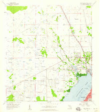
~ Fort Myers NW FL topo map, 1:24000 scale, 7.5 X 7.5 Minute, Historical, 1958, updated 1959
Fort Myers NW, Florida, USGS topographic map dated 1958.
Includes geographic coordinates (latitude and longitude). This topographic map is suitable for hiking, camping, and exploring, or framing it as a wall map.
Printed on-demand using high resolution imagery, on heavy weight and acid free paper, or alternatively on a variety of synthetic materials.
Topos available on paper, Waterproof, Poly, or Tyvek. Usually shipping rolled, unless combined with other folded maps in one order.
- Product Number: USGS-5624334
- Free digital map download (high-resolution, GeoPDF): Fort Myers NW, Florida (file size: 7 MB)
- Map Size: please refer to the dimensions of the GeoPDF map above
- Weight (paper map): ca. 55 grams
- Map Type: POD USGS Topographic Map
- Map Series: HTMC
- Map Verison: Historical
- Cell ID: 15968
- Scan ID: 346283
- Imprint Year: 1959
- Woodland Tint: Yes
- Aerial Photo Year: 1952
- Survey Year: 1958
- Datum: NAD27
- Map Projection: Polyconic
- Map published by United States Geological Survey
- Map Language: English
- Scanner Resolution: 600 dpi
- Map Cell Name: Fort Myers NW
- Grid size: 7.5 X 7.5 Minute
- Date on map: 1958
- Map Scale: 1:24000
- Geographical region: Florida, United States
Neighboring Maps:
All neighboring USGS topo maps are available for sale online at a variety of scales.
Spatial coverage:
Topo map Fort Myers NW, Florida, covers the geographical area associated the following places:
- Robert's Trailer Park - Del Tura Country Club Mobile Home Park - Evergreen Trailer Park - Mere's Mobile Home Park - W D Trailer Park - Island Vista Estates Mobile Home Park - Lochmoor Waterway Estates - Waterway Estates - Serendipity Mobile Home Park - Holiday Acres Laynes 1 Mobile Home Park - Fox Mobile Home Park - Twin Pines Village Number 1 Mobile Home Park - Swan Lake Mobile Home Village - North Fort Myers - Palmona Park - Tropical Palms Trailer Park - Swifts Trailer Park - Buccaneer Mobile Estates - Twin Pines Village Number 2 Mobile Home Park - The Heritage Mobile Home Park - Southern Villas Mobile Home Park - Horizon Mobile Home Village - Tara Woods Mobile Home Park - Jones Mobile Home Park - Windmill Village Mobile Home Park - Lake Fairways Country Club Mobile Home Park
- Map Area ID: AREA26.7526.625-82-81.875
- Northwest corner Lat/Long code: USGSNW26.75-82
- Northeast corner Lat/Long code: USGSNE26.75-81.875
- Southwest corner Lat/Long code: USGSSW26.625-82
- Southeast corner Lat/Long code: USGSSE26.625-81.875
- Northern map edge Latitude: 26.75
- Southern map edge Latitude: 26.625
- Western map edge Longitude: -82
- Eastern map edge Longitude: -81.875


