
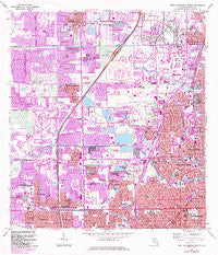
~ Fort Lauderdale North FL topo map, 1:24000 scale, 7.5 X 7.5 Minute, Historical, 1962, updated 1984
Fort Lauderdale North, Florida, USGS topographic map dated 1962.
Includes geographic coordinates (latitude and longitude). This topographic map is suitable for hiking, camping, and exploring, or framing it as a wall map.
Printed on-demand using high resolution imagery, on heavy weight and acid free paper, or alternatively on a variety of synthetic materials.
Topos available on paper, Waterproof, Poly, or Tyvek. Usually shipping rolled, unless combined with other folded maps in one order.
- Product Number: USGS-5624300
- Free digital map download (high-resolution, GeoPDF): Fort Lauderdale North, Florida (file size: 18 MB)
- Map Size: please refer to the dimensions of the GeoPDF map above
- Weight (paper map): ca. 55 grams
- Map Type: POD USGS Topographic Map
- Map Series: HTMC
- Map Verison: Historical
- Cell ID: 15938
- Scan ID: 346257
- Imprint Year: 1984
- Woodland Tint: Yes
- Photo Revision Year: 1983
- Aerial Photo Year: 1980
- Edit Year: 1983
- Field Check Year: 1962
- Survey Year: 1945
- Datum: NAD27
- Map Projection: Polyconic
- Map published by United States Geological Survey
- Map published by United States Department of Commerce
- Map Language: English
- Scanner Resolution: 600 dpi
- Map Cell Name: Fort Lauderdale North
- Grid size: 7.5 X 7.5 Minute
- Date on map: 1962
- Map Scale: 1:24000
- Geographical region: Florida, United States
Neighboring Maps:
All neighboring USGS topo maps are available for sale online at a variety of scales.
Spatial coverage:
Topo map Fort Lauderdale North, Florida, covers the geographical area associated the following places:
- Plantation Gardens - Wilton Manors - Margate - Lyons Park - Tamarac - Hammondville - Roosevelt Gardens - Coral Estates - North Andrews Gardens - Aztec Estates Mobile Home Park - Margate Estates - Coconut Creek Park - Palm Aire - Golf View Estates Mobile Home Park - Rock Island Village - Saint George - Pompano Park - Royal Palms Park - Pan American Estates Mobile Home Park - Jenada Isles - Brentwood Estates - Broadview - Royal Palm Isles - Golf Estates - Lauderhill - Franklin Park - Rock Island - Imperial Estates Mobile Home Park - Sabal Palms Estates - Sunrise Heights - Lauderdale Lakes - Middle River Trailer Park - Breezeswept Park Estates - Cypress Creek Mobile Home Country Club - Coral Woods - Plantation - North Lauderdale - Washington Park - Middle River Vista - Twin Lakes - Lazy Lake - Oakland Park - North Andrew Gardens - East Gate Park - Village Park Mobile Home Estates - Coral Heights - Browardale - Middle River - Fair Gate - Lloyds Estates - Carefree Cove Mobile Home Park - Broward Estates - Village Park - Collier Estates - Holiday Village Mobile Home Park - Collier Park - Flamingo Village
- Map Area ID: AREA26.2526.125-80.25-80.125
- Northwest corner Lat/Long code: USGSNW26.25-80.25
- Northeast corner Lat/Long code: USGSNE26.25-80.125
- Southwest corner Lat/Long code: USGSSW26.125-80.25
- Southeast corner Lat/Long code: USGSSE26.125-80.125
- Northern map edge Latitude: 26.25
- Southern map edge Latitude: 26.125
- Western map edge Longitude: -80.25
- Eastern map edge Longitude: -80.125


