
~ Elliott Key FL topo map, 1:24000 scale, 7.5 X 7.5 Minute, Historical, 1956, updated 1964
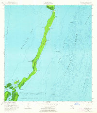
Elliott Key, Florida, USGS topographic map dated 1956.
Includes geographic coordinates (latitude and longitude). This topographic map is suitable for hiking, camping, and exploring, or framing it as a wall map.
Printed on-demand using high resolution imagery, on heavy weight and acid free paper, or alternatively on a variety of synthetic materials.
Topos available on paper, Waterproof, Poly, or Tyvek. Usually shipping rolled, unless combined with other folded maps in one order.
- Product Number: USGS-5623826
- Free digital map download (high-resolution, GeoPDF): Elliott Key, Florida (file size: 6 MB)
- Map Size: please refer to the dimensions of the GeoPDF map above
- Weight (paper map): ca. 55 grams
- Map Type: POD USGS Topographic Map
- Map Series: HTMC
- Map Verison: Historical
- Cell ID: 14118
- Scan ID: 345997
- Imprint Year: 1964
- Woodland Tint: Yes
- Aerial Photo Year: 1955
- Field Check Year: 1956
- Survey Year: 1947
- Datum: NAD27
- Map Projection: Polyconic
- Map published by United States Geological Survey
- Map published by United States Department of Commerce
- Map Language: English
- Scanner Resolution: 600 dpi
- Map Cell Name: Elliott Key
- Grid size: 7.5 X 7.5 Minute
- Date on map: 1956
- Map Scale: 1:24000
- Geographical region: Florida, United States
Neighboring Maps:
All neighboring USGS topo maps are available for sale online at a variety of scales.
Spatial coverage:
Topo map Elliott Key, Florida, covers the geographical area associated the following places:
- Sea Grape Point - Coon Point - Margot Fish Shoal - Petrel Point - Elliott Key - Long Reef - Elliott Key Visitor Center - Bache Shoal - Elliott Key Harbor - Porgy Key - Reid Key - Ajax Reef - Pacific Reef Channel - Christmas Point - Sandwich Cove - University Dock - Meigs Key - Totten Key - Elliott Key Park Harbor Light 2 - Billys Point - Ott Point - Legare Anchorage - Jones Point - Hurricane Creek - Point Adelle - Sands Cut - Adams Key - Rubicon Keys - Caesar Creek Bank - Log Point - Biscayne National Park - City of Islandia (historical) - Caesar Rock - Sawyer Cove - Caesar Creek
- Map Area ID: AREA25.525.375-80.25-80.125
- Northwest corner Lat/Long code: USGSNW25.5-80.25
- Northeast corner Lat/Long code: USGSNE25.5-80.125
- Southwest corner Lat/Long code: USGSSW25.375-80.25
- Southeast corner Lat/Long code: USGSSE25.375-80.125
- Northern map edge Latitude: 25.5
- Southern map edge Latitude: 25.375
- Western map edge Longitude: -80.25
- Eastern map edge Longitude: -80.125


