
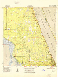
~ Eau Gallie FL topo map, 1:24000 scale, 7.5 X 7.5 Minute, Historical, 1951
Eau Gallie, Florida, USGS topographic map dated 1951.
Includes geographic coordinates (latitude and longitude). This topographic map is suitable for hiking, camping, and exploring, or framing it as a wall map.
Printed on-demand using high resolution imagery, on heavy weight and acid free paper, or alternatively on a variety of synthetic materials.
Topos available on paper, Waterproof, Poly, or Tyvek. Usually shipping rolled, unless combined with other folded maps in one order.
- Product Number: USGS-5623730
- Free digital map download (high-resolution, GeoPDF): Eau Gallie, Florida (file size: 9 MB)
- Map Size: please refer to the dimensions of the GeoPDF map above
- Weight (paper map): ca. 55 grams
- Map Type: POD USGS Topographic Map
- Map Series: HTMC
- Map Verison: Historical
- Cell ID: 13551
- Scan ID: 345944
- Woodland Tint: Yes
- Field Check Year: 1949
- Survey Year: 1949
- Datum: NAD27
- Map Projection: Polyconic
- Map published by United States Geological Survey
- Map published by United States Department of Commerce
- Map Language: English
- Scanner Resolution: 600 dpi
- Map Cell Name: Eau Gallie
- Grid size: 7.5 X 7.5 Minute
- Date on map: 1951
- Map Scale: 1:24000
- Geographical region: Florida, United States
Neighboring Maps:
All neighboring USGS topo maps are available for sale online at a variety of scales.
Spatial coverage:
Topo map Eau Gallie, Florida, covers the geographical area associated the following places:
- Lantern Village Mobile Home Park - Orange Trailer Manor Mobile Home Park - Sherman Park - Aurora Park Mobile Home Park - Broadview Mobile Home Park - Shady Oak Mobile Home Park - Happy Acres Mobile Home Park - Palm Shores - Indian River Trailer Park - Village Glen Mobile Home Park - Riverview Manufactured Home Community - West Eau Gallie - Hollandale Mobile Home Park - Aurora Pines Mobile Home Park - Pineda - Harbor Mobile Home Park - Johnson Mobile Home Park - Mobiland by the Sea - Rocky Water Park Mobile Home Park - Rachels Mobile Home Park - Big Oak Trailer Park - Hibiscus Mobile Haven - Aurora - Lotus - Eau Gallie - Viera - Tan Tara Mobile Home Park
- Map Area ID: AREA28.2528.125-80.75-80.625
- Northwest corner Lat/Long code: USGSNW28.25-80.75
- Northeast corner Lat/Long code: USGSNE28.25-80.625
- Southwest corner Lat/Long code: USGSSW28.125-80.75
- Southeast corner Lat/Long code: USGSSE28.125-80.625
- Northern map edge Latitude: 28.25
- Southern map edge Latitude: 28.125
- Western map edge Longitude: -80.75
- Eastern map edge Longitude: -80.625


