
~ Deep Lake SW FL topo map, 1:24000 scale, 7.5 X 7.5 Minute, Historical, 1959, updated 1968
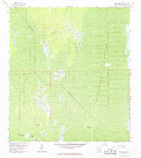
Deep Lake SW, Florida, USGS topographic map dated 1959.
Includes geographic coordinates (latitude and longitude). This topographic map is suitable for hiking, camping, and exploring, or framing it as a wall map.
Printed on-demand using high resolution imagery, on heavy weight and acid free paper, or alternatively on a variety of synthetic materials.
Topos available on paper, Waterproof, Poly, or Tyvek. Usually shipping rolled, unless combined with other folded maps in one order.
- Product Number: USGS-5623474
- Free digital map download (high-resolution, GeoPDF): Deep Lake SW, Florida (file size: 10 MB)
- Map Size: please refer to the dimensions of the GeoPDF map above
- Weight (paper map): ca. 55 grams
- Map Type: POD USGS Topographic Map
- Map Series: HTMC
- Map Verison: Historical
- Cell ID: 11708
- Scan ID: 345799
- Imprint Year: 1968
- Woodland Tint: Yes
- Aerial Photo Year: 1952
- Survey Year: 1959
- Datum: NAD27
- Map Projection: Polyconic
- Map published by United States Geological Survey
- Map Language: English
- Scanner Resolution: 600 dpi
- Map Cell Name: Deep Lake SW
- Grid size: 7.5 X 7.5 Minute
- Date on map: 1959
- Map Scale: 1:24000
- Geographical region: Florida, United States
Neighboring Maps:
All neighboring USGS topo maps are available for sale online at a variety of scales.
Spatial coverage:
Topo map Deep Lake SW, Florida, covers the geographical area associated the following places:
- Pretty Island - Starvation Prairie - Soft Prairie - Slate Prairie - Turkey Prairie - Picayune Strand - Dollar Prairie - West Prairie - Turnback Prairie - Buck Prairie - Royal Palm Hammock - Collier County - Burnt Flat Prairie - Long Prairie - Little Whitney Prairie - Fakahatchee Strand Preserve State Park - Twelvemile Prairie - Fakahatchee Strand - Plate Prairie - Bear Prairie - Doe Prairie
- Map Area ID: AREA26.12526-81.5-81.375
- Northwest corner Lat/Long code: USGSNW26.125-81.5
- Northeast corner Lat/Long code: USGSNE26.125-81.375
- Southwest corner Lat/Long code: USGSSW26-81.5
- Southeast corner Lat/Long code: USGSSE26-81.375
- Northern map edge Latitude: 26.125
- Southern map edge Latitude: 26
- Western map edge Longitude: -81.5
- Eastern map edge Longitude: -81.375


