
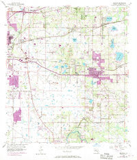
~ Brandon FL topo map, 1:24000 scale, 7.5 X 7.5 Minute, Historical, 1956, updated 1970
Brandon, Florida, USGS topographic map dated 1956.
Includes geographic coordinates (latitude and longitude). This topographic map is suitable for hiking, camping, and exploring, or framing it as a wall map.
Printed on-demand using high resolution imagery, on heavy weight and acid free paper, or alternatively on a variety of synthetic materials.
Topos available on paper, Waterproof, Poly, or Tyvek. Usually shipping rolled, unless combined with other folded maps in one order.
- Product Number: USGS-5622542
- Free digital map download (high-resolution, GeoPDF): Brandon, Florida (file size: 11 MB)
- Map Size: please refer to the dimensions of the GeoPDF map above
- Weight (paper map): ca. 55 grams
- Map Type: POD USGS Topographic Map
- Map Series: HTMC
- Map Verison: Historical
- Cell ID: 5263
- Scan ID: 345297
- Imprint Year: 1970
- Woodland Tint: Yes
- Photo Revision Year: 1969
- Aerial Photo Year: 1969
- Survey Year: 1956
- Datum: NAD27
- Map Projection: Polyconic
- Map published by United States Geological Survey
- Map Language: English
- Scanner Resolution: 600 dpi
- Map Cell Name: Brandon
- Grid size: 7.5 X 7.5 Minute
- Date on map: 1956
- Map Scale: 1:24000
- Geographical region: Florida, United States
Neighboring Maps:
All neighboring USGS topo maps are available for sale online at a variety of scales.
Spatial coverage:
Topo map Brandon, Florida, covers the geographical area associated the following places:
- Madrona Heights - Tangelo - Kenwood Acres - Hillcrest Mobile Estates - Huntington Woods - Ellsworth - Phillips Estates - Alafia Estates - Mango Hills - Estates at Limona Woods - Easy Way - Brandon Village - Limona - Fishers Farms - Oakridge Manor - Shady Oaks Park - Meadow Ridge Estates - Harvest Field - Oakmont Manor - Providence Oaks - Candlewood - Lakemont Hills - Kings Forest - Winston Manor - Clayton - Scenic Heights - Missouri Park - Oakwood Ravine - Chelsea Manor - Lake Marie Mobile Estates - Old Hillsborough Estates - Waldrop Estates - South Tampa - Buffalo Avenue Farms - Highland Manor - Butler Acres - Lynnhaven - Valrico Vista - Goins Terrace - Hillside - Fields Park Place - Eureka Homes - Sylvia Manor - Southwood Hills - Carrollton - Stratford - Lake Weeks - Frye - Amaya Estates - Paka Estates - Lakewood Ridge Estates North - Campos Valrico - Brandon Forest - Amys Acres - Nita Estates - Bloomingdale Village - Lake Saint Charles - Bell Shoals Gardens - The Willows - Buckhorn Creek - Villages of Lake Saint Charles - Brandon Gardens - Holiday Hills - Montclair Meadow - Val Villa - Stevens Manor - Causeway Manor - Brandon Valley - Broadway Heights East - Benson - Orange Grove Estates - Woodland Acres - Brandon Brook - Eden Park - Lake Brandon - Mango Terrace - Camelot Woods - East Gate Mobile Estates - Seffner - Mirror Crest - Oakwood Heights - Cambridge Place - Oakmont Park - Valrico Lake - Gold Coast - Hudsons Haven - Mango Groves - Valrico Heights Estates - Countryside Manor - Brandon - Watermill at Providence Lakes - Lynwood Park - Brandon Ridge - Cottagewood Oaks - Kingswood Heights - Happy Homes - Cashin Oaks - Delaney Woods - Hillside Manor - Ravenwood
- Map Area ID: AREA2827.875-82.375-82.25
- Northwest corner Lat/Long code: USGSNW28-82.375
- Northeast corner Lat/Long code: USGSNE28-82.25
- Southwest corner Lat/Long code: USGSSW27.875-82.375
- Southeast corner Lat/Long code: USGSSE27.875-82.25
- Northern map edge Latitude: 28
- Southern map edge Latitude: 27.875
- Western map edge Longitude: -82.375
- Eastern map edge Longitude: -82.25


