
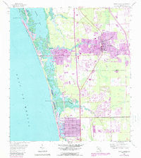
~ Bonita Springs FL topo map, 1:24000 scale, 7.5 X 7.5 Minute, Historical, 1958, updated 1988
Bonita Springs, Florida, USGS topographic map dated 1958.
Includes geographic coordinates (latitude and longitude). This topographic map is suitable for hiking, camping, and exploring, or framing it as a wall map.
Printed on-demand using high resolution imagery, on heavy weight and acid free paper, or alternatively on a variety of synthetic materials.
Topos available on paper, Waterproof, Poly, or Tyvek. Usually shipping rolled, unless combined with other folded maps in one order.
- Product Number: USGS-5622448
- Free digital map download (high-resolution, GeoPDF): Bonita Springs, Florida (file size: 14 MB)
- Map Size: please refer to the dimensions of the GeoPDF map above
- Weight (paper map): ca. 55 grams
- Map Type: POD USGS Topographic Map
- Map Series: HTMC
- Map Verison: Historical
- Cell ID: 4804
- Scan ID: 345245
- Imprint Year: 1988
- Woodland Tint: Yes
- Photo Revision Year: 1987
- Aerial Photo Year: 1984
- Edit Year: 1987
- Survey Year: 1958
- Datum: NAD27
- Map Projection: Polyconic
- Map published by United States Geological Survey
- Map Language: English
- Scanner Resolution: 600 dpi
- Map Cell Name: Bonita Springs
- Grid size: 7.5 X 7.5 Minute
- Date on map: 1958
- Map Scale: 1:24000
- Geographical region: Florida, United States
Neighboring Maps:
All neighboring USGS topo maps are available for sale online at a variety of scales.
Spatial coverage:
Topo map Bonita Springs, Florida, covers the geographical area associated the following places:
- Palm River Mobile Home Park - Bonita Springs - Palm River - Landmark Naples Mobile Home Park - Bonita Shores - Oak Creek Mobile Home Park - Tropicaire Trailer Park - Sabal Palm Court Mobile Home Park - Hometown Landmark Mobile Home Park - Naples Park - Barefoot Beach - Vanderbilt Beach - Willoughby Acres - Anglers Paradise of Bonita Springs Mobile Home Park - Palm River Shores - Imperial Bonita Estates Mobile Home Park - Bonita Saint James Village Mobile Home Park - Palm Lake Trailer and Camping Resort - Tropical Trailer Park - Caribbean Mobile Home Park - Vanderbilt Beach Estates - Gulf Harbor - Palm River Estates - Four Seasons
- Map Area ID: AREA26.37526.25-81.875-81.75
- Northwest corner Lat/Long code: USGSNW26.375-81.875
- Northeast corner Lat/Long code: USGSNE26.375-81.75
- Southwest corner Lat/Long code: USGSSW26.25-81.875
- Southeast corner Lat/Long code: USGSSE26.25-81.75
- Northern map edge Latitude: 26.375
- Southern map edge Latitude: 26.25
- Western map edge Longitude: -81.875
- Eastern map edge Longitude: -81.75


