
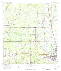
~ Antioch FL topo map, 1:24000 scale, 7.5 X 7.5 Minute, Historical, 1944, updated 1963
Antioch, Florida, USGS topographic map dated 1944.
Includes geographic coordinates (latitude and longitude). This topographic map is suitable for hiking, camping, and exploring, or framing it as a wall map.
Printed on-demand using high resolution imagery, on heavy weight and acid free paper, or alternatively on a variety of synthetic materials.
Topos available on paper, Waterproof, Poly, or Tyvek. Usually shipping rolled, unless combined with other folded maps in one order.
- Product Number: USGS-5621944
- Free digital map download (high-resolution, GeoPDF): Antioch, Florida (file size: 8 MB)
- Map Size: please refer to the dimensions of the GeoPDF map above
- Weight (paper map): ca. 55 grams
- Map Type: POD USGS Topographic Map
- Map Series: HTMC
- Map Verison: Historical
- Cell ID: 35570
- Scan ID: 344944
- Imprint Year: 1963
- Woodland Tint: Yes
- Aerial Photo Year: 1942
- Survey Year: 1944
- Datum: NAD27
- Map Projection: Polyconic
- Map published by United States Geological Survey
- Map Language: English
- Scanner Resolution: 600 dpi
- Map Cell Name: Plant City West
- Grid size: 7.5 X 7.5 Minute
- Date on map: 1944
- Map Scale: 1:24000
- Geographical region: Florida, United States
Neighboring Maps:
All neighboring USGS topo maps are available for sale online at a variety of scales.
Spatial coverage:
Topo map Antioch, Florida, covers the geographical area associated the following places:
- Fritzke Acres - Todd Estates - Lakewood Place - Dormany Oaks - Old Fashioned Acres - Kilgore - Pondside Gardens - Todd Acres - Hilltop Preserve - Orange Heights West - Sherwood - Gavin Estates - Lynn Oaks - Sparkman Heights - Bartons Country Estates - West Pines Village Mobile Home Park - Fritzke Estates - Eunice Estates - Spivey Acres - Moll Acres - Madison Park West - Poplin Acres - Roberts - Farkas Estates - Marcia Oaks - Henderson - Oak Park Heights - McIntosh Country Acres - Hales Estates - Moriczville - Cooks Cove - Hastings - Moores Lake Grove - Wayne Terrace - Kinard Cove - Antioch Place - Gallagher Estates - Ancient Oak - Julieann Acres - Ray - Grace Acres - Antioch - Mason Estates - Young Acres - Chadam - Robart Acres - Magnolias at Dawn - Greenleaf - New Hope - Gillett Acres - Gough Pless Estates - Riverleaf - Pine Dale Meadows - Pippin Acres - Cedar Run - Cooper Hollow - Madison Park East - Appling Woods - West Pinecrest - Vuorio Estates - North Pinecrest - Green Pastures - Madison Park - Marriott - Sand Hill Estates - Stallwood - Franklin Reserve - Kellers - Forest Park East - Long Fritzke - Jim Kirkland Acres - Key Woods Ranch - Evanell Estates - Homeland Park - Eurcelles - Stafford Oaks - Cherry Hill - Overstreet Acres - Knights - Shirley Ranch - Ham Acres - Bennett Acres - Rustic Oaks - Allen Peacock - Hallman Estates - Highland Grove - Manee - Fletchers Pond - Oakrest - Keene - Shelleys Corner - Madison Park South - The Oaks - Empire - Sunny Slopes - Rini Ranch - Sawyers Heavenbound Estates - Fullenkamp Acres - Reeves Estate - Saylor Estates
- Map Area ID: AREA28.12528-82.25-82.125
- Northwest corner Lat/Long code: USGSNW28.125-82.25
- Northeast corner Lat/Long code: USGSNE28.125-82.125
- Southwest corner Lat/Long code: USGSSW28-82.25
- Southeast corner Lat/Long code: USGSSE28-82.125
- Northern map edge Latitude: 28.125
- Southern map edge Latitude: 28
- Western map edge Longitude: -82.25
- Eastern map edge Longitude: -82.125


