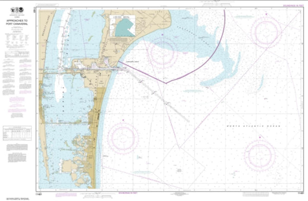
~ West Palm Beach FL topo map, 1:250000 scale, 1 X 2 Degree, Historical, 1956, updated 1974
West Palm Beach, Florida, USGS topographic map dated 1956.
Includes geographic coordinates (latitude and longitude). This topographic map is suitable for hiking, camping, and exploring, or framing it as a wall map.
Printed on-demand using high resolution imagery, on heavy weight and acid free paper, or alternatively on a variety of synthetic materials.
Topos available on paper, Waterproof, Poly, or Tyvek. Usually shipping rolled, unless combined with other folded maps in one order.
- Product Number: USGS-5621804
- Free digital map download (high-resolution, GeoPDF): West Palm Beach, Florida (file size: 19 MB)
- Map Size: please refer to the dimensions of the GeoPDF map above
- Weight (paper map): ca. 55 grams
- Map Type: POD USGS Topographic Map
- Map Series: HTMC
- Map Verison: Historical
- Cell ID: 69094
- Scan ID: 349057
- Imprint Year: 1974
- Woodland Tint: Yes
- Aerial Photo Year: 1971
- Edit Year: 1972
- Field Check Year: 1956
- Datum: Unstated
- Map Projection: Transverse Mercator
- Map published by: Military, Other
- Map Language: English
- Scanner Resolution: 600 dpi
- Map Cell Name: West Palm Beach
- Grid size: 1 X 2 Degree
- Date on map: 1956
- Map Scale: 1:250000
- Geographical region: Florida, United States
Neighboring Maps:
All neighboring USGS topo maps are available for sale online at a variety of scales.
Spatial coverage:
Topo map West Palm Beach, Florida, covers the geographical area associated the following places:
- Whiskey Creek - Villas - Slater - Whisper Walk - Tara Woods Mobile Home Park - Pelican Bay - Orange Grove Mobile Home Park - Southwest Ranches - Santa Barbara Shores - Flamingo Village - Sunshine Acres - Blue Heron Pines - Royal Manor Mobile Home Estates - Hell Gate - Stacey Street - Pine Ridge Trailer Park - Deem City - Cypress Lakes - Crystal Lake - Charleston Park - Davenport Mobile Home Park Number 3 - Holiday Village Mobile Home Park - Alva - Bean City - Hitching Post Mobile Home Park - Saint George - West Jupiter - Caloosahatchee (historical) - Tavares Cove Mobile Home Park - Dunes Road - Lauderdale-by-the-Sea - New England Mobile Estates - Plantation Park - Oaklane Mobile Home Park - Denaud - Plantation Acres - Nortmoor Courts Mobile Home Park - Sea Ranch Lakes - Krystal Lane Mobile Home Park - Riviera Beach - Haverhill - Palm River - Royal Palm Isles - Boca Pointe - Buccaneer Mobile Estates - Belle Glade Camp - Mohr's Trailer Park - Barefoot Beach - County Line Trailer Park - Pinecrest Mobile Home Park - Port Mayaca - Gladeview Mobile Home Park - Azalea Trailer Colony Mobile Home Park - Lantana - Pinehurst Village - A and P Trailer Court - Royal Palm Estates - Bonita Springs - Cape Coral - Lazy Lake - David Zell Trailer Park - Mission Bay - Cloud Lake - Harrisburg - Naples Manor - Robert's Trailer Park - Monkey Box - Sandalfoot Cove - Jenada Isles - Parkway Mobile Home Court - County Club Acres - Tequesta - Calusa Mobile Home Park - Rock Island Village - Deerfield Lake Mobile Home Park - Anglers Paradise of Bonita Springs Mobile Home Park - Council - Floridale Mobile Home Colony - Coral Woods - Breezeswept Park Estates - Salvista - Wellington - Marlboro Court Mobile Home Community - Tidewater Estates Mobile Home Park - Browns Farm - Oak Point - Fort Myers Beach - Sand Cut - Gateway - Palm Beach Farms - Port Everglades Junction - Tropical Trailer Gardens - Jamaica Bay West Mobile Home Park - Crystal Lake Club Mobile Home Park - Poinsettia Mobile Home Park - Driftwood Estates - Ocean Waterway Mobile Home Park - Twin Lakes Mobile Home Park - South Palm Beach - Holland Mobile Home Park
- Map Area ID: AREA2726-82-80
- Northwest corner Lat/Long code: USGSNW27-82
- Northeast corner Lat/Long code: USGSNE27-80
- Southwest corner Lat/Long code: USGSSW26-82
- Southeast corner Lat/Long code: USGSSE26-80
- Northern map edge Latitude: 27
- Southern map edge Latitude: 26
- Western map edge Longitude: -82
- Eastern map edge Longitude: -80

