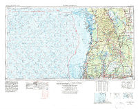
~ Tarpon Springs FL topo map, 1:250000 scale, 1 X 2 Degree, Historical, 1955, updated 1978
Tarpon Springs, Florida, USGS topographic map dated 1955.
Includes geographic coordinates (latitude and longitude). This topographic map is suitable for hiking, camping, and exploring, or framing it as a wall map.
Printed on-demand using high resolution imagery, on heavy weight and acid free paper, or alternatively on a variety of synthetic materials.
Topos available on paper, Waterproof, Poly, or Tyvek. Usually shipping rolled, unless combined with other folded maps in one order.
- Product Number: USGS-5621798
- Free digital map download (high-resolution, GeoPDF): Tarpon Springs, Florida (file size: 23 MB)
- Map Size: please refer to the dimensions of the GeoPDF map above
- Weight (paper map): ca. 55 grams
- Map Type: POD USGS Topographic Map
- Map Series: HTMC
- Map Verison: Historical
- Cell ID: 69047
- Scan ID: 348805
- Imprint Year: 1978
- Woodland Tint: Yes
- Visual Version Number: 1
- Aerial Photo Year: 1974
- Edit Year: 1977
- Field Check Year: 1955
- Datum: Unstated
- Map Projection: Transverse Mercator
- Map published by United States Geological Survey
- Map Language: English
- Scanner Resolution: 600 dpi
- Map Cell Name: Tarpon Springs
- Grid size: 1 X 2 Degree
- Date on map: 1955
- Map Scale: 1:250000
- Geographical region: Florida, United States
Neighboring Maps:
All neighboring USGS topo maps are available for sale online at a variety of scales.
Spatial coverage:
Topo map Tarpon Springs, Florida, covers the geographical area associated the following places:
- Varn Acres - Carr Drive - Lakewood Gardens - Futch Acres - Skewlee Gardens - McIntosh Meadows - Cumberland Manors - Water Oak - Holley Heights - Silver Oaks - Waterchase - Cedar Creek at Country Run - Indian Mound Estates - Carrollwood Crossing - Idle Forest - Poinsettia Park - Pinecrest Villa - Shirley Ranch - Cox Acres - Lakewood Manor - Killen Estates - Seminole Haven Mobile Home Park - Highway Heights - Dunedin - El Portal Terrace - Forest Hills Estates - Vilma Acres - West Park - The Oaks at Busch - River Chase - Tampa Overlook - Lake Ellen Grove - Cedar Cove - Temple Terrace - Wildes Pond - Imperial Estates - Heather Downs - Mark Hall Acres - Capri Manor - Maag - Plant City Heights - Trinity - Wesley Chapel - Belt Court - Brant Shores - Cheval Boulevard Estates East - Heatherton Heights - Webster - Sutton Estates - Coarsey Grove Estates - Hudson - Baker Acres - Ana Julia Estates - Horn Acres - Terrace Oaks - Ashlin Estates - Ansley Terrace - Cherry Hill - Ye Little Wood - Lake Dorothea Park - Wilma Farms - Alligator Bobs - Club Manor East of Grand Hampton - Keystone Groves - Frenchs - Brookshire - Hampton Lakes - Emerald Cove - Ralston Beach Manor - Martin Ranch - Village Estates - McCary - Variety Grove Estates - Keystone Park - Gilfort - The Manors of Nottingham - Cypress Willows - Rosewood Mobile Home Park - Lake Panasoffkee - Lake Magdalene Woods - Echols Lake Carroll Estates - Clay Sink - Trezevant - Beverly Hills - Lake Britton - Independence Square - Yent - Gilbertsen Acres - Sonoma Heights - River Bluffs - Floravilla - Bristol Park - Branchton - Riverhills Park - Phillips Trail - Pinker - Eastbrook - Mason Estates - Aldermans Addition - Pineview
- Map Area ID: AREA2928-84-82
- Northwest corner Lat/Long code: USGSNW29-84
- Northeast corner Lat/Long code: USGSNE29-82
- Southwest corner Lat/Long code: USGSSW28-84
- Southeast corner Lat/Long code: USGSSE28-82
- Northern map edge Latitude: 29
- Southern map edge Latitude: 28
- Western map edge Longitude: -84
- Eastern map edge Longitude: -82

