
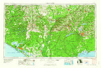
~ Tallahassee FL topo map, 1:250000 scale, 1 X 2 Degree, Historical, 1960, updated 1960
Tallahassee, Florida, USGS topographic map dated 1960.
Includes geographic coordinates (latitude and longitude). This topographic map is suitable for hiking, camping, and exploring, or framing it as a wall map.
Printed on-demand using high resolution imagery, on heavy weight and acid free paper, or alternatively on a variety of synthetic materials.
Topos available on paper, Waterproof, Poly, or Tyvek. Usually shipping rolled, unless combined with other folded maps in one order.
- Product Number: USGS-5621792
- Free digital map download (high-resolution, GeoPDF): Tallahassee, Florida (file size: 21 MB)
- Map Size: please refer to the dimensions of the GeoPDF map above
- Weight (paper map): ca. 55 grams
- Map Type: POD USGS Topographic Map
- Map Series: HTMC
- Map Verison: Historical
- Cell ID: 69044
- Scan ID: 348778
- Imprint Year: 1960
- Woodland Tint: Yes
- Field Check Year: 1954
- Datum: Unstated
- Map Projection: Transverse Mercator
- Map published by United States Army Corps of Engineers
- Map published by United States Army
- Map Language: English
- Scanner Resolution: 600 dpi
- Map Cell Name: Tallahassee
- Grid size: 1 X 2 Degree
- Date on map: 1960
- Map Scale: 1:250000
- Geographical region: Florida, United States
Neighboring Maps:
All neighboring USGS topo maps are available for sale online at a variety of scales.
Spatial coverage:
Topo map Tallahassee, Florida, covers the geographical area associated the following places:
- Magnolia Beach - Battle Ground Forks - Pleasant Hill (historical) - Cody - Darsey - Cook - Perkins - Izagora - Holland Crossroads - Gritney - Two Egg - Gardner - Majette - Couch - Florence - McCaln - Parramore - Zion Hill - Sink Creek - Conners Ford - Cedar Grove - Miccosukee - Iola - Whigham - Saunders - Cobb Cross Roads - Greenhead - Bahoma - Clio - Vilas - Gaskins - Resota Beach - Ocklockonee (historical) - Crawfordville - Midway - Alford - Bethel - Central City - Paradise Acres - Chattahoochee - Chipley - Chason - Brock Crossroad - Collins Mill - Parker - Allanton - Early - Liberty - Open Sands - Hoover Mill - Littman - Royals Crossroads - Shady Rest - Fort Braden - New Hope - Dogtown - Dirego Park - Ocheesee - Tendil Crossing - Homestead Ridge - San Marcos (historical) - Simsville - Cerrogordo - Upper Grand Lagoon - Baker Settlement - Edgewater Gulf Beach - Rosedale - Owl Landing - Sunnyside - Rose - Climax - Henderson Mill - Hornsville - Brownlee - Orange - Buena Vista - Wadesboro - Fairchild - Midway - Noma Junction - Holmes Valley - Bayou George - Bristol - Grantham - Rocky Hill - Kern - Clarksville - Lela - Altha - Long Branch - Bethany - Scotts Ferry - Saint Andrew - Red Head - Sawdust - Mosquito Landing - Calvary - Sylvania - Rollins Corner - Macom
- Map Area ID: AREA3130-86-84
- Northwest corner Lat/Long code: USGSNW31-86
- Northeast corner Lat/Long code: USGSNE31-84
- Southwest corner Lat/Long code: USGSSW30-86
- Southeast corner Lat/Long code: USGSSE30-84
- Northern map edge Latitude: 31
- Southern map edge Latitude: 30
- Western map edge Longitude: -86
- Eastern map edge Longitude: -84


