
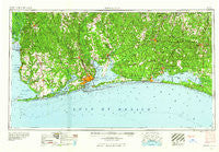
~ Pensacola FL topo map, 1:250000 scale, 1 X 2 Degree, Historical, 1960, updated 1960
Pensacola, Florida, USGS topographic map dated 1960.
Includes geographic coordinates (latitude and longitude). This topographic map is suitable for hiking, camping, and exploring, or framing it as a wall map.
Printed on-demand using high resolution imagery, on heavy weight and acid free paper, or alternatively on a variety of synthetic materials.
Topos available on paper, Waterproof, Poly, or Tyvek. Usually shipping rolled, unless combined with other folded maps in one order.
- Product Number: USGS-5621770
- Free digital map download (high-resolution, GeoPDF): Pensacola, Florida (file size: 17 MB)
- Map Size: please refer to the dimensions of the GeoPDF map above
- Weight (paper map): ca. 55 grams
- Map Type: POD USGS Topographic Map
- Map Series: HTMC
- Map Verison: Historical
- Cell ID: 72242
- Scan ID: 348066
- Imprint Year: 1960
- Woodland Tint: Yes
- Field Check Year: 1957
- Datum: Unstated
- Map Projection: Transverse Mercator
- Map published by United States Army Corps of Engineers
- Map published by United States Army
- Map Language: English
- Scanner Resolution: 600 dpi
- Map Cell Name: Pensacola
- Grid size: 1 X 2 Degree
- Date on map: 1960
- Map Scale: 1:250000
- Geographical region: Florida, United States
Neighboring Maps:
All neighboring USGS topo maps are available for sale online at a variety of scales.
Spatial coverage:
Topo map Pensacola, Florida, covers the geographical area associated the following places:
- Old Bratt Road Estates - Good Hope - Myrtle Grove - Spring Hill - Cannon Town - Magnolia Beach - Cerny Heights - La Bonne Vie Mobile Home Park - Dickman Mobile Home Park - Gordon - Park City - Cedarbreeze Mobile Home Park - Cypress Acres Mobile Home Park - Woodlawn Beach - Seminole - Spence Mobile Home Park - Blue Grass Recreational Vehicle Park - Key Allegro Villas Mobile Home Park - Liberty - Seacliff - The Grove Mobile Home Park - Dixon - Lakewood - Simmons Crossing - Brownsdale - Daphne Mobile Home Park - Alys Beach - South Flomaton - Happy Valley - McKinnon - Stockton - Miramar Beach - Cinco Bayou - Oleander Court Mobile Home Park - Milton - Robertsdale - Dana Point - Seaglades - Floridatown - Dorcas - Point Clear - Blue Mountain Beach - Pine Bluff - Koerber - Cedar Grove Mobile Home Park - Gulf Pines - Freeport - Dana Point - Gulf Highlands - Yniestra - Johnsons Beach - Moye Hill Park Mobile Home Park - Avalon Beach - Carpenter - Styx River Estates - Tristan Village - Molino - Vangordon - Pelican Mobile Home Park - Pineville - Svea - Gateswood - Romar Beach - Elberta - Yupon - Fairhope - Sand Cut - Montrose - Eucheeanna - Carlees Mobile Home Court - Goulding - Blackmon Trailer Park - Forest Highlands - Pulliam Village Mobile Home Park - Santa Maria - Avondale - Belforest - Loyola Villa - Palmetto Beach - Center Ridge - Gasque - Byrneville - Magnolia Springs - Hughes Mobile Home Park - Alpine Heights - Turquoise Beach - Molino Crossroads - Parkway Mobile Home Park - Foley Recreational Vehicle Park - Holley - Harp - Berrydale - Orchards Mobile Home Park - Sanders Beach - Galt City - Houstonville - Seascape - Oak Grove - Gulf Beach Heights - New York
- Map Area ID: AREA3130-88-86
- Northwest corner Lat/Long code: USGSNW31-88
- Northeast corner Lat/Long code: USGSNE31-86
- Southwest corner Lat/Long code: USGSSW30-88
- Southeast corner Lat/Long code: USGSSE30-86
- Northern map edge Latitude: 31
- Southern map edge Latitude: 30
- Western map edge Longitude: -88
- Eastern map edge Longitude: -86


