
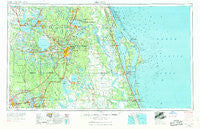
~ Orlando FL topo map, 1:250000 scale, 1 X 2 Degree, Historical, 1955, updated 1969
Orlando, Florida, USGS topographic map dated 1955.
Includes geographic coordinates (latitude and longitude). This topographic map is suitable for hiking, camping, and exploring, or framing it as a wall map.
Printed on-demand using high resolution imagery, on heavy weight and acid free paper, or alternatively on a variety of synthetic materials.
Topos available on paper, Waterproof, Poly, or Tyvek. Usually shipping rolled, unless combined with other folded maps in one order.
- Product Number: USGS-5621758
- Free digital map download (high-resolution, GeoPDF): Orlando, Florida (file size: 18 MB)
- Map Size: please refer to the dimensions of the GeoPDF map above
- Weight (paper map): ca. 55 grams
- Map Type: POD USGS Topographic Map
- Map Series: HTMC
- Map Verison: Historical
- Cell ID: 68950
- Scan ID: 347862
- Imprint Year: 1969
- Woodland Tint: Yes
- Edit Year: 1962
- Field Check Year: 1955
- Datum: Unstated
- Map Projection: Transverse Mercator
- Map published by United States Army Corps of Engineers
- Map published by United States Army
- Map Language: English
- Scanner Resolution: 600 dpi
- Map Cell Name: Orlando
- Grid size: 1 X 2 Degree
- Date on map: 1955
- Map Scale: 1:250000
- Geographical region: Florida, United States
Neighboring Maps:
All neighboring USGS topo maps are available for sale online at a variety of scales.
Spatial coverage:
Topo map Orlando, Florida, covers the geographical area associated the following places:
- Cocoa Beach - Country Life I Mobile Home Park - Fort Mason - Palms Trailer Park - Truck Corner - L and M Mobile Court - Beacon Hill Colony Mobile Home Park - Silver Lake - Palm Bay - Recreation Plantation Resort - Hillcrest Heights Trailer Park - Bide A While Mobile Home Park - Lake Buena Vista - Dawson Mobile Home Park - Bellwood - Fishermans Wharf Mobile Home Park - Loughman - El Red Manor Mobile Home Park - Trailer Haven Mobile Home Park - Fatio - Enterprise - Pittman - Twelve Oaks Mobile Home Park - Fern Park - Beulah - Carol Sligar Mobile Home Park - Cisky Park - Aurora Park Mobile Home Park - College Mobile Park - Stanton - South Clermont - Farmton - Hollandale Mobile Home Park - Wilson - The Groves Mobile Home Park - Friendly Shores Mobile Home Park - Big Oak Park Mobile Home Park - Diamond Acres Mobile Park - South Shore Mobile Home Park - Aurora Pines Mobile Home Park - Cypress Shores Mobile Home Park - Colorado Court Mobile Home Park - Intercession City - Lamplighter Village III Mobile Home Park - Spring Lake Mobile Home Park - Hidden Valley Mobile Home Park - Sorrento - Three Palms Trailer Park - Hickory Hollow Estates Mobile Home Park - Balmers Mobile Home Park - Foxwood Lake Mobile Home Park - Tropical Whisper Mobile Home Park - Helens Mobile Home Park - Rail's End Mobile Home Park - Lake Griffin Harbor Mobile Home Park - Imperial Trailer Court - Royal Palm Village Mobile Home Park - Haven on Lake Harris Mobile Home Park - Country Squire Mobile Home Village - Stengel Mobile Home Park - Johnson Mobile Home Park - J and M Mobile Home Park - Hilltop Mobile Home Park - Lakewood Village Mobile Home Community - May Grove Mobile Home Park - Deerwood Mobile Home Park - Lake Bonny Mobile Home Park - Conestoga Mobile Home Park - Wekiwa Springs - Kris Mobile Home Park - Pleasant Hill Village Mobile Home Park - Marsh's Trailer Park - Williams Trailer Park - South Lake Conway Villa - Alderene Park - Trailer City Mobile Home Park - Alafaya Woods - Orange City - Alamana - Twin Oaks Park Mobile Home Park - Village of la Casa del Sol Mobile Home Park - Cocoa Point Park Mobile Home Park - Umatilla - Morningside Park - Sunset Mobile Home Park - Lucerne Park - Audubon - Snow Hill - The Villages - Iowa City - Eloise Woods - Lakeside Mobile Home Court - Wilsons Trailer Park - Anglers Cove Mobile Home Park - Orange Tree Village Mobile Home Park - Lake Hammock Village - Oakland - Pine Grove Mobile Home Park - Bookertown - Riley's Park Mobile Home Park
- Map Area ID: AREA2928-82-80
- Northwest corner Lat/Long code: USGSNW29-82
- Northeast corner Lat/Long code: USGSNE29-80
- Southwest corner Lat/Long code: USGSSW28-82
- Southeast corner Lat/Long code: USGSSE28-80
- Northern map edge Latitude: 29
- Southern map edge Latitude: 28
- Western map edge Longitude: -82
- Eastern map edge Longitude: -80


