
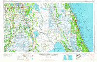
~ Fort Pierce FL topo map, 1:250000 scale, 1 X 2 Degree, Historical, 1956, updated 1965
Fort Pierce, Florida, USGS topographic map dated 1956.
Includes geographic coordinates (latitude and longitude). This topographic map is suitable for hiking, camping, and exploring, or framing it as a wall map.
Printed on-demand using high resolution imagery, on heavy weight and acid free paper, or alternatively on a variety of synthetic materials.
Topos available on paper, Waterproof, Poly, or Tyvek. Usually shipping rolled, unless combined with other folded maps in one order.
- Product Number: USGS-5621714
- Free digital map download (high-resolution, GeoPDF): Fort Pierce, Florida (file size: 17 MB)
- Map Size: please refer to the dimensions of the GeoPDF map above
- Weight (paper map): ca. 55 grams
- Map Type: POD USGS Topographic Map
- Map Series: HTMC
- Map Verison: Historical
- Cell ID: 68784
- Scan ID: 346310
- Imprint Year: 1965
- Woodland Tint: Yes
- Edit Year: 1964
- Field Check Year: 1956
- Datum: Unstated
- Map Projection: Transverse Mercator
- Map published by United States Army Corps of Engineers
- Map published by United States Army
- Map Language: English
- Scanner Resolution: 600 dpi
- Map Cell Name: Fort Pierce
- Grid size: 1 X 2 Degree
- Date on map: 1956
- Map Scale: 1:250000
- Geographical region: Florida, United States
Neighboring Maps:
All neighboring USGS topo maps are available for sale online at a variety of scales.
Spatial coverage:
Topo map Fort Pierce, Florida, covers the geographical area associated the following places:
- Highland City - Tropical Acres Mobile Home Park - Sebring Village Mobile Home Park - Lake Fox Village Mobile Home Park - Childs - Pine Level - Lemon Grove - Lily - Winter Haven Mobile Home Park - Indian Lake Estates - Santa Fe Mobile Home Park - Salerno Trailer Park - Lakefront Trailer Park - Lokosee - Riomar - Sewall's Point - Hammock Mobile Estates Mobile Home Park - Sylvan Shores - H and H Mobile Home Park - Peace River Mobile Home Park - Sunshine Park Mobile Home Park - Johnsons Trailer Park - Sunrise Trailer Park - Floritan - Indiantown - Ackel Mobile Home Estates - Lakeshore Palms Travel Park - Jackson Creek Mobile Estates - Gloria Park Mobile Home Park - Kuhlman - Sweetwater Mobile Home Park - Harrells Mobile Home Park - Bennetts Mobile Home Park - Saint Lucie - Lakeland Highlands - Whispering Palms Mobile Village - Sebring Resort Mobile Home Park - Homeland - Lazy Bee Mobile Home Park - Lakewood Park - Country Cove Mobile Home Community - Ona - Dun Runnin Park Mobile Home Park - Hillcrest Heights - Hicoria - Alturas - Palm Lake Club Mobile Home Park - Sebring - Crystal Lake Mobile Home Park - Stuart - Collins Park Estates - Lorida - Sand Hill Mobile Home Park - Wolfolk - Tanglewood Mobile Home Park - Coachland Court Mobile Home Park - Arcadia Municipal Mobile Home Park - Twin Palms Mobile Home Park - Southfort - Breezeway Mobile Home Park - Hendersons Mobile Home Park - Jacobs Trailer Park - Florida Ridge - Eighth Street Mobile Home Park - Yeehaw - Grace Mobile Home Park - Plains - Coker - Cummings - Melbourne Shores - Countryside at Vero Beach Mobile Home Park - Avon Park Lakes - Coral Gardens - Cacema Town (historical) - Lake Pointe Village Mobile Home Park - Port Sewall - Hen Scratch - El Capitan Mobile Home Park - South Beach - Neilson - Walton - Tiger Bay - Bradley Junction - Barcola - Happy Hour Park Mobile Home Park - Terio's Mobile Home Park - Fuller Heights - Thomas Landing Mobile Home Park - Chelette Manor Mobile Home Park - La Fiesta Trailer Park - Harmony Heights - Roux Quarters - Eldred - Open Gate Trailer Park - Gifford - Sunset Mobile Home Park - Wauchula - Highland Wheel Estates Mobile Home Park - Lake Millsite Estates Mobile Home Park - Agricola
- Map Area ID: AREA2827-82-80
- Northwest corner Lat/Long code: USGSNW28-82
- Northeast corner Lat/Long code: USGSNE28-80
- Southwest corner Lat/Long code: USGSSW27-82
- Southeast corner Lat/Long code: USGSSE27-80
- Northern map edge Latitude: 28
- Southern map edge Latitude: 27
- Western map edge Longitude: -82
- Eastern map edge Longitude: -80


