
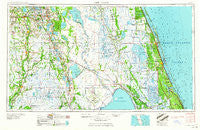
~ Fort Pierce FL topo map, 1:250000 scale, 1 X 2 Degree, Historical, 1959, updated 1959
Fort Pierce, Florida, USGS topographic map dated 1959.
Includes geographic coordinates (latitude and longitude). This topographic map is suitable for hiking, camping, and exploring, or framing it as a wall map.
Printed on-demand using high resolution imagery, on heavy weight and acid free paper, or alternatively on a variety of synthetic materials.
Topos available on paper, Waterproof, Poly, or Tyvek. Usually shipping rolled, unless combined with other folded maps in one order.
- Product Number: USGS-5621712
- Free digital map download (high-resolution, GeoPDF): Fort Pierce, Florida (file size: 16 MB)
- Map Size: please refer to the dimensions of the GeoPDF map above
- Weight (paper map): ca. 55 grams
- Map Type: POD USGS Topographic Map
- Map Series: HTMC
- Map Verison: Historical
- Cell ID: 68784
- Scan ID: 346309
- Imprint Year: 1959
- Woodland Tint: Yes
- Visual Version Number: 1
- Field Check Year: 1956
- Datum: Unstated
- Map Projection: Transverse Mercator
- Map published by United States Geological Survey
- Map published by United States Army Corps of Engineers
- Map published by United States Army
- Map Language: English
- Scanner Resolution: 600 dpi
- Map Cell Name: Fort Pierce
- Grid size: 1 X 2 Degree
- Date on map: 1959
- Map Scale: 1:250000
- Geographical region: Florida, United States
Neighboring Maps:
All neighboring USGS topo maps are available for sale online at a variety of scales.
Spatial coverage:
Topo map Fort Pierce, Florida, covers the geographical area associated the following places:
- Ridgewood - Roseland - Rosemont Mobile Home Park - Lake Pointe Village Mobile Home Park - Palm Village Mobile Home Park - Pedaler's Pond Mobile Home Park - Ona - Lake Clinch Manor Mobile Home Park - Jerrys Park Mobile Home Park - Childs - Stuart - El Capitan Mobile Home Park - North River Shores - Torpey Oaks Mobile Home Park - Southern Pines Mobile Home Resort - Hebel Acres Mobile Home Park - Sanlan Ranch Mobile Home Park - Brentwood Mobile Home Park - Sebring Resort Mobile Home Park - Southgate Village Mobile Home Park - Green Bay - Tower Lakes Mobile Home Park - Indiantown - Village Green Mobile Home Park - Cypress Knee Cove Mobile Home Park - South Mulberry - Natalie Estates Mobile Home Park - Bereah - Open Gate Trailer Park - Harmony Heights - Hammock Mobile Estates Mobile Home Park - Emily's Glen Mobile Home Park - Wauchula Hills - Joshua - Ackel Mobile Home Estates - Ballard Pines - Alpine - Globe Mobile Home Park - Jensen Beach - Cox Corner - Hammock Lake Mobile Estates - Royal Poinciana Park - Griffins Corner - Indian River Shores - Pinelake Gardens Estates - Rio - Chapman Trailer Park - The Palms Mobile Home Park - Tiger Bay - Lindale Mobile Home Park - Rainbow Trailer Park - Maggie Runyon Trailer Park - Riomar - Walden Shores Mobile Home Park - Washburn Mobile Home Park - Grove Shores Mobile Colony - Palm Paradise Mobile Home Park - Lokosee - Azteca Mobile Home Park - Port Salerno - Whittier - Sweetwater - Royal Oaks Community Mobile Home Park - Lake Millsite Estates Mobile Home Park - Eloise - Highlands Park Estates - Seabreeze Mobile Manor - Whidden Mobile Home Park Number 2 - Fedhaven - Poinciana Park - Barber Quarters - Eighth Street Mobile Home Park - Winter Beach - Rifle Range Mobile Home - Sunset Mobile Home Park - Highland Village Mobile Home Park - Walton - Up the Grove Beach - Palm City - 46th Avenue Villas Mobile Home Park - Waverly - Fort Pierce Shores - Katies Korner Mobile Home Park - S P Mobile Home Park - Wild Island - Lakeland Highlands - Orange Blossom Fellowship Community Mobile Home Park - Jacobs Trailer Park - Colony Club Mobile Home Park - Golden Gate - Pinelake Village Mobile Home Park - Lily - Spanish Lakes Country Club Village Mobile Home Park - Jupiter Island - Mulberry - Seminole Village Mobile Home Park - Vero Mobile Home Park - Ranchland Mobile Home Park - Wabasso Beach - Indian River Estates
- Map Area ID: AREA2827-82-80
- Northwest corner Lat/Long code: USGSNW28-82
- Northeast corner Lat/Long code: USGSNE28-80
- Southwest corner Lat/Long code: USGSSW27-82
- Southeast corner Lat/Long code: USGSSE27-80
- Northern map edge Latitude: 28
- Southern map edge Latitude: 27
- Western map edge Longitude: -82
- Eastern map edge Longitude: -80


