
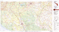
~ Perry FL topo map, 1:100000 scale, 30 X 60 Minute, Historical, 1979, updated 1980
Perry, Florida, USGS topographic map dated 1979.
Includes geographic coordinates (latitude and longitude). This topographic map is suitable for hiking, camping, and exploring, or framing it as a wall map.
Printed on-demand using high resolution imagery, on heavy weight and acid free paper, or alternatively on a variety of synthetic materials.
Topos available on paper, Waterproof, Poly, or Tyvek. Usually shipping rolled, unless combined with other folded maps in one order.
- Product Number: USGS-5621662
- Free digital map download (high-resolution, GeoPDF): Perry, Florida (file size: 25 MB)
- Map Size: please refer to the dimensions of the GeoPDF map above
- Weight (paper map): ca. 55 grams
- Map Type: POD USGS Topographic Map
- Map Series: HTMC
- Map Verison: Historical
- Cell ID: 68137
- Scan ID: 348086
- Imprint Year: 1980
- Woodland Tint: Yes
- Visual Version Number: 1
- Aerial Photo Year: 1974
- Edit Year: 1979
- Datum: NAD27
- Map Projection: Universal Transverse Mercator
- Map published by United States Geological Survey
- Map Language: English
- Scanner Resolution: 600 dpi
- Map Cell Name: Perry
- Grid size: 30 X 60 Minute
- Date on map: 1979
- Map Scale: 1:100000
- Geographical region: Florida, United States
Neighboring Maps:
All neighboring USGS topo maps are available for sale online at a variety of scales.
Spatial coverage:
Topo map Perry, Florida, covers the geographical area associated the following places:
- Day - Midway - Nutall Rise - Lee - Aucilla (historical) - Fair Road Mobile Home Court - Capps - Peterson - Lamont - Blue Springs - Ilcombe (historical) - Fort Union - Perry - Mayo Junction - Lancaster - Hampton Springs - Wayne Friers Mobile Home Park - Toponanaulka (historical) - Hatchcakamocha (historical) - Secotan - San Juan de Guacara (historical) - Scanlon - Greenville - Roach - Stern - Atawalia (historical) - Fenholloway - Box Canyon Mobile Home Park - Holmes Trailer Park - Covington - Chancey - Townsend - Dell - Reams - San Pedro Junction - Iddo - Sirmans - Starr - Foley - Boyd - Cabbage Grove - Mercer - Newburn - San Pedro Poturiba (historical) - San Lorenzo Ibitachuco (historical) - Everetts Mobile Home Park - Nugalla (historical) - Buckhorn - Hopewell - Pinland - Econfina - Hamaste (historical) - Alton - Ahosulga (historical) - Willanocha (historical) - Adams - Mayo - Luraville - Wacissa - San Luis Apalache (historical) - Bucell Junction - Thomas City - Westgate Mobile Home Park - Madison - New Mikasuki (historical) - Eridu - Dowling Park - Falmouth - Aucilla - Drifton - Ebb - Shady Grove - Buckville - Ellaville - San Francisco de Oconi (historical) - Dickert - Waylonzo - Mandalay - Wacissa (historical) - Crossroads - Nash - Waukeenah
- Map Area ID: AREA30.530-84-83
- Northwest corner Lat/Long code: USGSNW30.5-84
- Northeast corner Lat/Long code: USGSNE30.5-83
- Southwest corner Lat/Long code: USGSSW30-84
- Southeast corner Lat/Long code: USGSSE30-83
- Northern map edge Latitude: 30.5
- Southern map edge Latitude: 30
- Western map edge Longitude: -84
- Eastern map edge Longitude: -83


