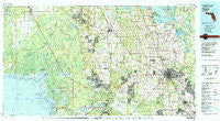
~ Ocala FL topo map, 1:100000 scale, 30 X 60 Minute, Historical, 1978, updated 1980
Ocala, Florida, USGS topographic map dated 1978.
Includes geographic coordinates (latitude and longitude). This topographic map is suitable for hiking, camping, and exploring, or framing it as a wall map.
Printed on-demand using high resolution imagery, on heavy weight and acid free paper, or alternatively on a variety of synthetic materials.
Topos available on paper, Waterproof, Poly, or Tyvek. Usually shipping rolled, unless combined with other folded maps in one order.
- Product Number: USGS-5621642
- Free digital map download (high-resolution, GeoPDF): Ocala, Florida (file size: 29 MB)
- Map Size: please refer to the dimensions of the GeoPDF map above
- Weight (paper map): ca. 55 grams
- Map Type: POD USGS Topographic Map
- Map Series: HTMC
- Map Verison: Historical
- Cell ID: 68077
- Scan ID: 347735
- Imprint Year: 1980
- Woodland Tint: Yes
- Aerial Photo Year: 1977
- Edit Year: 1978
- Datum: NAD27
- Map Projection: Universal Transverse Mercator
- Map published by United States Geological Survey
- Map Language: English
- Scanner Resolution: 600 dpi
- Map Cell Name: Ocala
- Grid size: 30 X 60 Minute
- Date on map: 1978
- Map Scale: 1:100000
- Geographical region: Florida, United States
Neighboring Maps:
All neighboring USGS topo maps are available for sale online at a variety of scales.
Spatial coverage:
Topo map Ocala, Florida, covers the geographical area associated the following places:
- Westwood Mobile Home Park - Live Oaks Mobile Home Park - Cross Creek - Ocala Ridge - Hopes Mobile Home Park - Cala Springs Mobile Home Park - Oakcrest Mobile Home Park - Golden Hills Park Mobile Home Park - Golden Hills - Pine Village Mobile Home Park - Silver Springs - Golden Pond Village Manufactured Home Community - Chatmire - Fort Drane - Clifton Mobile City Mobile Home Park - Ocala Thoroughbred Acres - Briar Patch Mobile Home Park - Villages of Ocala West Mobile Home Park - Belleview Mobile Home Park - Golden Meadows Mobile Home Park - Penny Park Estates Mobile Home Park - Compton Mobile Home Park - Santos Mobile Home Park - Rainbow Falls - Edgewood Mobile Home Park - Oakwood Mobile Manor Mobile Home Park - Cotton Plant - Yankeetown - Bahia Oaks - Paynes Town (historical) - Merediths - Ocala Highlands Estates - Lakeside Travel Park - Oak Mobile Home Park - Western Mobile Home Park - Romeo - Sweetwater Oaks Mobile Home Park - Rolling Greens Mobile Home Park - Sherman Oaks - Paddock Park South Mobile Home Park - Millwood - Ocala Estates - Ross Prairie - Inglis - Raleigh - Twin Oaks Mobile Home Park - Country Town Village Mobile Home Park - Williston Highlands - Cherry Hill Mobile Home Park - Green Oaks Manor Mobile Home Park - Arbors of Ocala Mobile Home Park - Rolling Ranches - Ocala - Chiefland - Dunnellon Square Mobile Home Village - Terry's Mobile Home Park - Oak - Heijahs Town (historical) - Ocala Municipal Trailer Park - Rainbow Lakes Estates - Regal Park - Saddle Oak Club Mobile Home Park - Emathla - Blue Skies Estates Mobile Home Park - Dogwood Acres Mobile Home Park - Sparr - Tidewater - Cara - Anthony - Morriston - Marion Oaks - Crackertown - Flemington - McIntosh - Fairfield Village of Ocala Mobile Home Park - Sumner - Huntington - Happy Acres Mobile Home Park - Meadow Lark Mobile Home Park - Early Bird - Misty Lane Mobile Home Park - Adam - Mount Olive - Villages of Ocala East Mobile Home Park - Quail Meadows - Orange Lake - Ocala Waterway - Victory Mobile Home Park - Gateway Mobile Home Park - Rocksprings - Camp Roosevelt - Ocala Sun RV Resort - Usher - Monroes Corner - Williston - The Falls of Ocala Mobile Home Park - Maricamp - Pinecrest Mobile Home Park - Evinston - Country Aire Mobile Home Park
- Map Area ID: AREA29.529-83-82
- Northwest corner Lat/Long code: USGSNW29.5-83
- Northeast corner Lat/Long code: USGSNE29.5-82
- Southwest corner Lat/Long code: USGSSW29-83
- Southeast corner Lat/Long code: USGSSE29-82
- Northern map edge Latitude: 29.5
- Southern map edge Latitude: 29
- Western map edge Longitude: -83
- Eastern map edge Longitude: -82

