
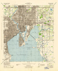
~ Tampa FL topo map, 1:31680 scale, 7.5 X 7.5 Minute, Historical, 1944
Tampa, Florida, USGS topographic map dated 1944.
Includes geographic coordinates (latitude and longitude). This topographic map is suitable for hiking, camping, and exploring, or framing it as a wall map.
Printed on-demand using high resolution imagery, on heavy weight and acid free paper, or alternatively on a variety of synthetic materials.
Topos available on paper, Waterproof, Poly, or Tyvek. Usually shipping rolled, unless combined with other folded maps in one order.
- Product Number: USGS-5621012
- Free digital map download (high-resolution, GeoPDF): Tampa, Florida (file size: 8 MB)
- Map Size: please refer to the dimensions of the GeoPDF map above
- Weight (paper map): ca. 55 grams
- Map Type: POD USGS Topographic Map
- Map Series: HTMC
- Map Verison: Historical
- Cell ID: 44262
- Scan ID: 348787
- Woodland Tint: Yes
- Aerial Photo Year: 1942
- Datum: NAD27
- Map Projection: Polyconic
- Map published by United States Army Corps of Engineers
- Map published by United States Department of War
- Map Language: English
- Scanner Resolution: 600 dpi
- Map Cell Name: Tampa
- Grid size: 7.5 X 7.5 Minute
- Date on map: 1944
- Map Scale: 1:31680
- Geographical region: Florida, United States
Neighboring Maps:
All neighboring USGS topo maps are available for sale online at a variety of scales.
Spatial coverage:
Topo map Tampa, Florida, covers the geographical area associated the following places:
- Asbury Park - Blue Moon Court - Tyner - Maine Park - The Quarter at Ybor - Howard Terrace - Fortuna - Aberdeen on Glen - Harding - Sedita - Rosalie - Wells Shopping Center - Princess Park - Guterman - Jackson Heights - Fishers - West Naples - Oakland Park - Bel Wil - Fiorito - Oakford - West Bay Bluff - East Suwanee Heights - Courtney Place - Lamont - Flehartys - Sperry - Pardeau Shores - Oakridge - Montana City - Pons - Belle Vista - Casey - Chesterfield Heights - Madison-Cole - Bettis - Harbourside at Harbour Island - Hagle - Rubideaux Landing - Hankins Virginia Heights - Dorothy Park - Broadway - Weiss - Maudot Village - Al Dana Park - Eckland - Tampa Springs Estates - Calvinos Liberty - Tradewinds - Palm River Terrace - Roslyn Homes - Pierce - McCallum Park - Hyde Park West - Thrashers - Harbour Court - Silva City - East Bay - Pimm - Gardenville - The Pointe at Harbour Island - Uceta Heights - Buffalo - Shell Point - Oak Gardens - Hendry Manor - Corona - Siglo Viente - Alma Heights - Glenwood Acres - Fulton - Florence Villa - Swann Albany - Riverside Estates - Western Heights - Leone Estates - Buffalo Heights - El Valle de Tampa - West Highlands - Silver Moon - Boulevard Heights - Booker T Park - Highland Estates East - Grant Park - Hidden Haven - Cass Street - Packwood - Terra Nova - Melville Heights - West Land - Baywood - La Petite - Crilly - Keys - Goodwater - Marc I - Bungalow City - Dyal - The Park on Bayshore - Belmont
- Map Area ID: AREA2827.875-82.5-82.375
- Northwest corner Lat/Long code: USGSNW28-82.5
- Northeast corner Lat/Long code: USGSNE28-82.375
- Southwest corner Lat/Long code: USGSSW27.875-82.5
- Southeast corner Lat/Long code: USGSSE27.875-82.375
- Northern map edge Latitude: 28
- Southern map edge Latitude: 27.875
- Western map edge Longitude: -82.5
- Eastern map edge Longitude: -82.375


