
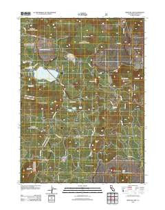
~ Medicine Lake CA topo map, 1:24000 scale, 7.5 X 7.5 Minute, Historical, 2012
Medicine Lake, California, USGS topographic map dated 2012.
Includes geographic coordinates (latitude and longitude). This topographic map is suitable for hiking, camping, and exploring, or framing it as a wall map.
Printed on-demand using high resolution imagery, on heavy weight and acid free paper, or alternatively on a variety of synthetic materials.
Topos available on paper, Waterproof, Poly, or Tyvek. Usually shipping rolled, unless combined with other folded maps in one order.
- Product Number: USGS-5620466
- Free digital map download (high-resolution, GeoPDF): Medicine Lake, California (file size: 26 MB)
- Map Size: please refer to the dimensions of the GeoPDF map above
- Weight (paper map): ca. 55 grams
- Map Type: POD USGS Topographic Map
- Map Series: US Topo
- Map Verison: Historical
- Cell ID: 28659
- Datum: North American Datum of 1983
- Map Projection: Transverse Mercator
- Map Cell Name: Medicine Lake
- Grid size: 7.5 X 7.5 Minute
- Date on map: 2012
- Map Scale: 1:24000
- Geographical region: California, United States
Neighboring Maps:
All neighboring USGS topo maps are available for sale online at a variety of scales.
Spatial coverage:
Topo map Medicine Lake, California, covers the geographical area associated the following places:
- Telephone Flat - Medicine Mountain - Lyons Peak - Alcohol Crater - Schonchin Spring - Hot Spot - Paynes Springs - Arnica Sink - Mount Hoffman - Brownell Meadow - Little Medicine Lake - Yellowjacket Butte - Crystal Springs - Red Shale Butte - Burnt Lava Flow Geological Area - Bruin Flat - Shotgun Peak - Bullseye Lake - Medicine Lake Glass Flow - Glass Mountain - Six Shooter Butte - Medicine Lake - Iodine Prairie - Blanche Lake - High Hole Crater - Undertakers Camp
- Map Area ID: AREA41.62541.5-121.625-121.5
- Northwest corner Lat/Long code: USGSNW41.625-121.625
- Northeast corner Lat/Long code: USGSNE41.625-121.5
- Southwest corner Lat/Long code: USGSSW41.5-121.625
- Southeast corner Lat/Long code: USGSSE41.5-121.5
- Northern map edge Latitude: 41.625
- Southern map edge Latitude: 41.5
- Western map edge Longitude: -121.625
- Eastern map edge Longitude: -121.5


