
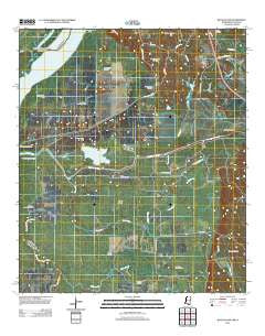
~ Buck Island MS topo map, 1:24000 scale, 7.5 X 7.5 Minute, Historical, 2012
Buck Island, Mississippi, USGS topographic map dated 2012.
Includes geographic coordinates (latitude and longitude). This topographic map is suitable for hiking, camping, and exploring, or framing it as a wall map.
Printed on-demand using high resolution imagery, on heavy weight and acid free paper, or alternatively on a variety of synthetic materials.
Topos available on paper, Waterproof, Poly, or Tyvek. Usually shipping rolled, unless combined with other folded maps in one order.
- Product Number: USGS-5620364
- Free digital map download (high-resolution, GeoPDF): Buck Island, Mississippi (file size: 30 MB)
- Map Size: please refer to the dimensions of the GeoPDF map above
- Weight (paper map): ca. 55 grams
- Map Type: POD USGS Topographic Map
- Map Series: US Topo
- Map Verison: Historical
- Cell ID: 5874
- Datum: North American Datum of 1983
- Map Projection: Transverse Mercator
- Map Cell Name: Buck Island
- Grid size: 7.5 X 7.5 Minute
- Date on map: 2012
- Map Scale: 1:24000
- Geographical region: Mississippi, United States
Neighboring Maps:
All neighboring USGS topo maps are available for sale online at a variety of scales.
Spatial coverage:
Topo map Buck Island, Mississippi, covers the geographical area associated the following places:
- Mills Bayou - Lake Lucile - Sibley Oil Field - Hutchins Creek - Cavass Bayou - Coles Bayou - Southeast Fairview Oil Field - Second Creek Watershed Structure One Dam - Running Bayou - Coulson Bayou - North Lake Lucille Oil Field - Tom Bayou - Walnut Creek - Sinai Church - Hutchins Landing Oil Field - Buckhurst Oil Field - Ellis Lake Oil Field - Gilliard Lake Oil Field - T K Armstrong Catfish Ponds Dam - Glasscock Oil Field - D C Barksdale Lake Dam - Cypress Bayou - Shieldsboro Oil Field - Washout Bayou Oil Field - Hutchins Creek Dam - Tansey Island - Armstrong Lake Dam - Rose Hill Oil Field - South Glen Aubin Oil Field - Gaillards Lake - East Fairview Oil Field - Goose Lake - Buck Island - Mills Bayou Oil Field - Lake Lucille Oil Field - Round Lake - Abernathy Channel - Deer Park School - Forked Lake - Becks Bay - Brushy Bayou - North Ellis Lake Oil Field - Mud Flats Bayou - Armstrong Canal
- Map Area ID: AREA31.37531.25-91.5-91.375
- Northwest corner Lat/Long code: USGSNW31.375-91.5
- Northeast corner Lat/Long code: USGSNE31.375-91.375
- Southwest corner Lat/Long code: USGSSW31.25-91.5
- Southeast corner Lat/Long code: USGSSE31.25-91.375
- Northern map edge Latitude: 31.375
- Southern map edge Latitude: 31.25
- Western map edge Longitude: -91.5
- Eastern map edge Longitude: -91.375


