
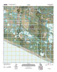
~ Cow Island LA topo map, 1:24000 scale, 7.5 X 7.5 Minute, Historical, 2012
Cow Island, Louisiana, USGS topographic map dated 2012.
Includes geographic coordinates (latitude and longitude). This topographic map is suitable for hiking, camping, and exploring, or framing it as a wall map.
Printed on-demand using high resolution imagery, on heavy weight and acid free paper, or alternatively on a variety of synthetic materials.
Topos available on paper, Waterproof, Poly, or Tyvek. Usually shipping rolled, unless combined with other folded maps in one order.
- Product Number: USGS-5619604
- Free digital map download (high-resolution, GeoPDF): Cow Island, Louisiana (file size: 14 MB)
- Map Size: please refer to the dimensions of the GeoPDF map above
- Weight (paper map): ca. 55 grams
- Map Type: POD USGS Topographic Map
- Map Series: US Topo
- Map Verison: Historical
- Cell ID: 10430
- Datum: North American Datum of 1983
- Map Projection: Transverse Mercator
- Map Cell Name: Cow Island
- Grid size: 7.5 X 7.5 Minute
- Date on map: 2012
- Map Scale: 1:24000
- Geographical region: Louisiana, United States
Neighboring Maps:
All neighboring USGS topo maps are available for sale online at a variety of scales.
Spatial coverage:
Topo map Cow Island, Louisiana, covers the geographical area associated the following places:
- Price Lake - Alligator Lake - Joseph Harbor Bayou - Teal Lake - Circle Cemetery - Round Lake - Saint Eugene Church - Nunez Airport (historical) - Sturlese Lake - Second Lake Gas Field - Cow Island - Tiger Island - Miller Lake - Second Lake - Little Pecan Oil and Gas Field - Tolan Lake - Price Lake Gas Field - Grand Chenier Ridge - Headquarters Canal - Claibert Lake
- Map Area ID: AREA29.7529.625-92.875-92.75
- Northwest corner Lat/Long code: USGSNW29.75-92.875
- Northeast corner Lat/Long code: USGSNE29.75-92.75
- Southwest corner Lat/Long code: USGSSW29.625-92.875
- Southeast corner Lat/Long code: USGSSE29.625-92.75
- Northern map edge Latitude: 29.75
- Southern map edge Latitude: 29.625
- Western map edge Longitude: -92.875
- Eastern map edge Longitude: -92.75


