
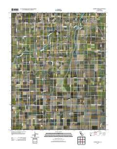
~ Burris Park CA topo map, 1:24000 scale, 7.5 X 7.5 Minute, Historical, 2012
Burris Park, California, USGS topographic map dated 2012.
Includes geographic coordinates (latitude and longitude). This topographic map is suitable for hiking, camping, and exploring, or framing it as a wall map.
Printed on-demand using high resolution imagery, on heavy weight and acid free paper, or alternatively on a variety of synthetic materials.
Topos available on paper, Waterproof, Poly, or Tyvek. Usually shipping rolled, unless combined with other folded maps in one order.
- Product Number: USGS-5619110
- Free digital map download (high-resolution, GeoPDF): Burris Park, California (file size: 20 MB)
- Map Size: please refer to the dimensions of the GeoPDF map above
- Weight (paper map): ca. 55 grams
- Map Type: POD USGS Topographic Map
- Map Series: US Topo
- Map Verison: Historical
- Cell ID: 6381
- Datum: North American Datum of 1983
- Map Projection: Transverse Mercator
- Map Cell Name: Burris Park
- Grid size: 7.5 X 7.5 Minute
- Date on map: 2012
- Map Scale: 1:24000
- Geographical region: California, United States
Neighboring Maps:
All neighboring USGS topo maps are available for sale online at a variety of scales.
Spatial coverage:
Topo map Burris Park, California, covers the geographical area associated the following places:
- North Branch Island Canal - Five J's Dairy - Willow Grove Farms Dairy - KJET-FM (Kingsburg) - Clough Ditch - Peoples Weir 79 - Dover Dairy - Kings County Fire Department Station 1 Burris Park - Riverside Ditch - KJET-FM (Kingsburg) - Settlers Ditch - River Bend School - McClanahan Ditch - Fagundes Ranch - Triple F Ranch - Island Canal - Burris Park - South Branch Island Canal - Dias and Dias Dairy Complex - Hanford Northeast Division - Bishop Canal - Excelsior School - Ward Drainage Canal - Lakeland Canal
- Map Area ID: AREA36.536.375-119.625-119.5
- Northwest corner Lat/Long code: USGSNW36.5-119.625
- Northeast corner Lat/Long code: USGSNE36.5-119.5
- Southwest corner Lat/Long code: USGSSW36.375-119.625
- Southeast corner Lat/Long code: USGSSE36.375-119.5
- Northern map edge Latitude: 36.5
- Southern map edge Latitude: 36.375
- Western map edge Longitude: -119.625
- Eastern map edge Longitude: -119.5


