
~ Livingston MT topo map, 1:250000 scale, 1 X 1 Degree, Historical, 1893
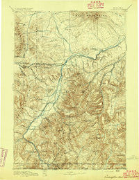
Livingston, Montana, USGS topographic map dated 1893.
Includes geographic coordinates (latitude and longitude). This topographic map is suitable for hiking, camping, and exploring, or framing it as a wall map.
Printed on-demand using high resolution imagery, on heavy weight and acid free paper, or alternatively on a variety of synthetic materials.
Topos available on paper, Waterproof, Poly, or Tyvek. Usually shipping rolled, unless combined with other folded maps in one order.
- Product Number: USGS-5618616
- Free digital map download (high-resolution, GeoPDF): Livingston, Montana (file size: 10 MB)
- Map Size: please refer to the dimensions of the GeoPDF map above
- Weight (paper map): ca. 55 grams
- Map Type: POD USGS Topographic Map
- Map Series: HTMC
- Map Verison: Historical
- Cell ID: 322316
- Scan ID: 268785
- Survey Year: 1887
- Datum: Unstated
- Map Projection: Unstated
- Map published by United States Geological Survey
- Map Language: English
- Scanner Resolution: 600 dpi
- Map Cell Name: Bozeman E
- Grid size: 1 X 1 Degree
- Date on map: 1893
- Map Scale: 1:250000
- Geographical region: Montana, United States
Neighboring Maps:
All neighboring USGS topo maps are available for sale online at a variety of scales.
Spatial coverage:
Topo map Livingston, Montana, covers the geographical area associated the following places:
- Wormser (historical) - Carbella - Dailey (historical) - Calamity Janes Trailer Court - Minnie Rahn Place - Riverside Addition - Independence - Geyser Trailer Park - Chico Hot Springs - Sioux Crossing - Rocky Mountain Trailer Park - Elton - Stumps Subdivision - Kotke - Hoppers - Park Addition - Corwin Springs - Sedan - Shaw Place - Merriman - Hoffman - Emigrant - Storrs (historical) - Miner - Clyde Park - Pray - Woods Place - Dahl Place - Aldridge - Five Acre Tracts/Acreville Addition - Gardiner - Golden Age Village Trailer Park - Jardine - Electric - Green Acres Addition - Bensons Landing (historical) - Sphinx - Upper Bridger (historical) - Wilsall - Carney - Shields - White City - Chimney Rock - Brisbin - Canyon View Trailer Court - Glastonbury - Lower Bridger (historical) - West End - Reistad Trailer Court - Park Road Trailer Court - Minnesota Addition - Montanapolis Springs (historical) - North Glastonbury - Chestnut - Urback Place - McLeod - Chicory - Springdale - Star Addition - Chadborn - Branding Iron Addition - High Ground Addition - Chico - Contact - Pine Creek - South Glastonbury - Grannis - Hunters Hot Springs - Palace Addition - Muir - Penwells (historical) - Lazy Day (historical) - Livingston
- Map Area ID: AREA4645-111-110
- Northwest corner Lat/Long code: USGSNW46-111
- Northeast corner Lat/Long code: USGSNE46-110
- Southwest corner Lat/Long code: USGSSW45-111
- Southeast corner Lat/Long code: USGSSE45-110
- Northern map edge Latitude: 46
- Southern map edge Latitude: 45
- Western map edge Longitude: -111
- Eastern map edge Longitude: -110


