
~ Sioux Falls SD topo map, 1:250000 scale, 1 X 2 Degree, Historical, 1958
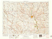
Sioux Falls, South Dakota, USGS topographic map dated 1958.
Includes geographic coordinates (latitude and longitude). This topographic map is suitable for hiking, camping, and exploring, or framing it as a wall map.
Printed on-demand using high resolution imagery, on heavy weight and acid free paper, or alternatively on a variety of synthetic materials.
Topos available on paper, Waterproof, Poly, or Tyvek. Usually shipping rolled, unless combined with other folded maps in one order.
- Product Number: USGS-5609180
- Free digital map download (high-resolution, GeoPDF): Sioux Falls, South Dakota (file size: 19 MB)
- Map Size: please refer to the dimensions of the GeoPDF map above
- Weight (paper map): ca. 55 grams
- Map Type: POD USGS Topographic Map
- Map Series: HTMC
- Map Verison: Historical
- Cell ID: 69033
- Scan ID: 344867
- Woodland Tint: Yes
- Datum: Unstated
- Map Projection: Transverse Mercator
- Map published by United States Army Corps of Engineers
- Map published by United States Army
- Map Language: English
- Scanner Resolution: 600 dpi
- Map Cell Name: Sioux Falls
- Grid size: 1 X 2 Degree
- Date on map: 1958
- Map Scale: 1:250000
- Geographical region: South Dakota, United States
Neighboring Maps:
All neighboring USGS topo maps are available for sale online at a variety of scales.
Spatial coverage:
Topo map Sioux Falls, South Dakota, covers the geographical area associated the following places:
- Kanaranzi - Hartford - Marion - Pine Lakes Addition - Epiphany - Midland - Steen - Rumpus Ridge - Beloit - Hurley - Smiths Park - Middleburg - Jamesville - Bridgewater - Klondike - Chancellor - Jasper - Norway Center - Orland - Silver Valley Addition - Turkey Ridge - Edgerton - Lakewood (historical) - Stanley Corner - Baltic - Peninsula Park - Inwood - Norton Acres - Klein Subdivision - Split Rock Heights - Granite - Clayton - Pumpkin Center - Orland Colony - Worthing - Canova - Renner - Unityville - Carmel - Milltown - Naomi - East Sioux Falls - Harrisburg - Lebanon - Spring Valley - Ellis Corner - Farwell - Valley Springs - Morefield - Chautauqua - Franklin - Ash Creek - Spencer - South Sioux Falls (historical) - El Rancho Acres - Irene - Colman - Lennox - Viborg - Colfax Corner - Wentworth - Sorum Heights - Jasper Sunrise Village - Sherman - Trosky - McCroskey Addition - Riverside (historical) - Renner Corner - Star Corner (historical) - Canistota - Ethan - Orange City - Rockport Colony - Ingberg Tracts - Booge - Garretson - Hudson - Doon - Salem - Rock Valley - Olivet - Meadow View Addition - Komstad (historical) - Maxwell Colony - Boyden - Froelich Addition - Skyline Heights - Upland Colony - Oak Lane Colony - Davis - Chester - Egan - Kaylor - Wolf Creek - Shannon Colony - Parkston - Manley - Vedin Corner - Tschetter Colony - Dolton
- Map Area ID: AREA4443-98-96
- Northwest corner Lat/Long code: USGSNW44-98
- Northeast corner Lat/Long code: USGSNE44-96
- Southwest corner Lat/Long code: USGSSW43-98
- Southeast corner Lat/Long code: USGSSE43-96
- Northern map edge Latitude: 44
- Southern map edge Latitude: 43
- Western map edge Longitude: -98
- Eastern map edge Longitude: -96


