
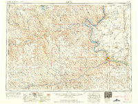
~ Pierre SD topo map, 1:250000 scale, 1 X 2 Degree, Historical, 1958
Pierre, South Dakota, USGS topographic map dated 1958.
Includes geographic coordinates (latitude and longitude). This topographic map is suitable for hiking, camping, and exploring, or framing it as a wall map.
Printed on-demand using high resolution imagery, on heavy weight and acid free paper, or alternatively on a variety of synthetic materials.
Topos available on paper, Waterproof, Poly, or Tyvek. Usually shipping rolled, unless combined with other folded maps in one order.
- Product Number: USGS-5609168
- Free digital map download (high-resolution, GeoPDF): Pierre, South Dakota (file size: 20 MB)
- Map Size: please refer to the dimensions of the GeoPDF map above
- Weight (paper map): ca. 55 grams
- Map Type: POD USGS Topographic Map
- Map Series: HTMC
- Map Verison: Historical
- Cell ID: 68960
- Scan ID: 344861
- Woodland Tint: Yes
- Datum: Unstated
- Map Projection: Transverse Mercator
- Map published by United States Army Corps of Engineers
- Map published by United States Army
- Map Language: English
- Scanner Resolution: 600 dpi
- Map Cell Name: Pierre
- Grid size: 1 X 2 Degree
- Date on map: 1958
- Map Scale: 1:250000
- Geographical region: South Dakota, United States
Neighboring Maps:
All neighboring USGS topo maps are available for sale online at a variety of scales.
Spatial coverage:
Topo map Pierre, South Dakota, covers the geographical area associated the following places:
- Gorman - Milesville - Midland - Nowlin - Bunker (historical) - Lacy - Cherry Creek - Elbon - Onida - Capa - Ottumwa - Okobojo - Pierre - Lucerne - Oahe - Fort Pierre - Philip - Agar - Alto - Teton - Chase - Gray Goose - Mission Ridge - Moenville - Pheba (historical) - Orton - Van Metre - Hayes - Kirley - Hartley - Powell - Sansarc - Dowling (historical) - Hilland - West Fork - Bridger - Wendte - Rousseau - Canning - Grindstone - Elevenmile Corner - Red Scaffold - Billsburg - Eakin
- Map Area ID: AREA4544-102-100
- Northwest corner Lat/Long code: USGSNW45-102
- Northeast corner Lat/Long code: USGSNE45-100
- Southwest corner Lat/Long code: USGSSW44-102
- Southeast corner Lat/Long code: USGSSE44-100
- Northern map edge Latitude: 45
- Southern map edge Latitude: 44
- Western map edge Longitude: -102
- Eastern map edge Longitude: -100


