
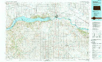
~ Yankton SD topo map, 1:100000 scale, 30 X 60 Minute, Historical, 1985, updated 1989
Yankton, South Dakota, USGS topographic map dated 1985.
Includes geographic coordinates (latitude and longitude). This topographic map is suitable for hiking, camping, and exploring, or framing it as a wall map.
Printed on-demand using high resolution imagery, on heavy weight and acid free paper, or alternatively on a variety of synthetic materials.
Topos available on paper, Waterproof, Poly, or Tyvek. Usually shipping rolled, unless combined with other folded maps in one order.
- Product Number: USGS-5608940
- Free digital map download (high-resolution, GeoPDF): Yankton, South Dakota (file size: 28 MB)
- Map Size: please refer to the dimensions of the GeoPDF map above
- Weight (paper map): ca. 55 grams
- Map Type: POD USGS Topographic Map
- Map Series: HTMC
- Map Verison: Historical
- Cell ID: 68622
- Scan ID: 344730
- Imprint Year: 1989
- Woodland Tint: Yes
- Aerial Photo Year: 1984
- Edit Year: 1985
- Datum: NAD27
- Map Projection: Universal Transverse Mercator
- Map published by United States Geological Survey
- Map Language: English
- Scanner Resolution: 600 dpi
- Map Cell Name: Yankton
- Grid size: 30 X 60 Minute
- Date on map: 1985
- Map Scale: 1:100000
- Geographical region: South Dakota, United States
Neighboring Maps:
All neighboring USGS topo maps are available for sale online at a variety of scales.
Spatial coverage:
Topo map Yankton, South Dakota, covers the geographical area associated the following places:
- Fairview Heights - Bloomfield Trailer Court - Pleasant Valley - Northshore Development - Bow Valley - Saint James - Sparta - Mission Hill - Running Water - Saybrook (historical) - Bluff Center (historical) - Tyndall - Hartington - Volin - Coleridge - Bon Homme Colony - Obert - Menominee - Bloomfield - Springfield - Valleyview - Westreville - Winnetoon - Tabor - Center - Aten - Bazile Mills - Saint Helena - Oak Hills Addition - Tewsville - Constance - Lakeport - Gayville - South Yankton - Utica - Fordyce - Lindy - Wynot - Bow Valley Mills - Santee - Napa Junction - Meckling - Yankton - Kingsburg - Crofton
- Map Area ID: AREA4342.5-98-97
- Northwest corner Lat/Long code: USGSNW43-98
- Northeast corner Lat/Long code: USGSNE43-97
- Southwest corner Lat/Long code: USGSSW42.5-98
- Southeast corner Lat/Long code: USGSSE42.5-97
- Northern map edge Latitude: 43
- Southern map edge Latitude: 42.5
- Western map edge Longitude: -98
- Eastern map edge Longitude: -97


