
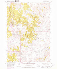
~ Wind Cave SD topo map, 1:24000 scale, 7.5 X 7.5 Minute, Historical, 1957, updated 1979
Wind Cave, South Dakota, USGS topographic map dated 1957.
Includes geographic coordinates (latitude and longitude). This topographic map is suitable for hiking, camping, and exploring, or framing it as a wall map.
Printed on-demand using high resolution imagery, on heavy weight and acid free paper, or alternatively on a variety of synthetic materials.
Topos available on paper, Waterproof, Poly, or Tyvek. Usually shipping rolled, unless combined with other folded maps in one order.
- Product Number: USGS-5608584
- Free digital map download (high-resolution, GeoPDF): Wind Cave, South Dakota (file size: 12 MB)
- Map Size: please refer to the dimensions of the GeoPDF map above
- Weight (paper map): ca. 55 grams
- Map Type: POD USGS Topographic Map
- Map Series: HTMC
- Map Verison: Historical
- Cell ID: 49392
- Scan ID: 344542
- Imprint Year: 1979
- Woodland Tint: Yes
- Photo Revision Year: 1979
- Aerial Photo Year: 1976
- Edit Year: 1979
- Field Check Year: 1957
- Datum: NAD27
- Map Projection: Polyconic
- Map published by United States Geological Survey
- Map Language: English
- Scanner Resolution: 600 dpi
- Map Cell Name: Wind Cave
- Grid size: 7.5 X 7.5 Minute
- Date on map: 1957
- Map Scale: 1:24000
- Geographical region: South Dakota, United States
Neighboring Maps:
All neighboring USGS topo maps are available for sale online at a variety of scales.
Spatial coverage:
Topo map Wind Cave, South Dakota, covers the geographical area associated the following places:
- Norbeck Lake - Reaves Gulch - Negro Canyon - Streeter Ranch - Wildcat Canyon - Rankin Ridge - Wind Cave National Park - Seven-11 Ranch - Gobbler Ridge - Windy Point - Martin Valley - Red Valley - Elk Mountain Campgrounds - Bison Flats - Elk Mountain - Martin Valley School - Gobbler Canyon - Lookout Point - Curley Canyon - Negro Wool Ridge - Dry Creek - Cold Spring Creek - Nobeck Dam - Wind Cave Canyon - Limestone Canyon - Cottonwood Creek - Sanson Ranch - Prairie Dog Canyon - Pigtail Bridge - Zuber Ranch - Highland Creek - Gobbler Pass
- Map Area ID: AREA43.62543.5-103.5-103.375
- Northwest corner Lat/Long code: USGSNW43.625-103.5
- Northeast corner Lat/Long code: USGSNE43.625-103.375
- Southwest corner Lat/Long code: USGSSW43.5-103.5
- Southeast corner Lat/Long code: USGSSE43.5-103.375
- Northern map edge Latitude: 43.625
- Southern map edge Latitude: 43.5
- Western map edge Longitude: -103.5
- Eastern map edge Longitude: -103.375


