
~ Battleship Rock SD topo map, 1:24000 scale, 7.5 X 7.5 Minute, Historical, 2005, updated 2007
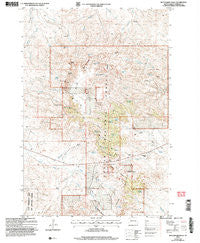
Battleship Rock, South Dakota, USGS topographic map dated 2005.
Includes geographic coordinates (latitude and longitude). This topographic map is suitable for hiking, camping, and exploring, or framing it as a wall map.
Printed on-demand using high resolution imagery, on heavy weight and acid free paper, or alternatively on a variety of synthetic materials.
Topos available on paper, Waterproof, Poly, or Tyvek. Usually shipping rolled, unless combined with other folded maps in one order.
- Product Number: USGS-5604866
- Free digital map download (high-resolution, GeoPDF): Battleship Rock, South Dakota (file size: 16 MB)
- Map Size: please refer to the dimensions of the GeoPDF map above
- Weight (paper map): ca. 55 grams
- Map Type: POD USGS Topographic Map
- Map Series: HTMC
- Map Verison: Historical
- Cell ID: 2667
- Scan ID: 342705
- Imprint Year: 2007
- Woodland Tint: Yes
- Aerial Photo Year: 2004
- Datum: NAD83
- Map Projection: Universal Transverse Mercator
- Map published by United States Geological Survey
- Map published by United States Forest Service
- Map Language: English
- Scanner Resolution: 600 dpi
- Map Cell Name: Battleship Rock
- Grid size: 7.5 X 7.5 Minute
- Date on map: 2005
- Map Scale: 1:24000
- Geographical region: South Dakota, United States
Neighboring Maps:
All neighboring USGS topo maps are available for sale online at a variety of scales.
Spatial coverage:
Topo map Battleship Rock, South Dakota, covers the geographical area associated the following places:
- Lena Spring Number One - Prairie Woman Spring - Battleship Rock - Log Spring - Reva Campground - Lone Tree Spring - Cliff Pond - Bonniwell Spring Number Two - Harry Spring - Bobcat Canyon - Thybo Well - North Spring - Atterbury Spring - Red Cross Spring - West Spring - Tepee Canyon Creek - Soap Hole Spring - Puckeroo Spring - Bonniwell Spring Number One - Saddle Point - Reva (historical) - Lermeny Ranch - Reva Gap - Government Hill - Mitchell Draw - Moonshine Lake - Split Log Spring - Running Spring - Window Rock - Doc Hodge Draw - Olson Ranch - Old Doc Spring - Verhulst Spring - Lena Spring Number Two - Castle Creek - Helms Ranch - The Castles - Little Joe Spring - Ivers Mine - Red Cross Draw - Flag Rock
- Map Area ID: AREA45.62545.5-103.25-103.125
- Northwest corner Lat/Long code: USGSNW45.625-103.25
- Northeast corner Lat/Long code: USGSNE45.625-103.125
- Southwest corner Lat/Long code: USGSSW45.5-103.25
- Southeast corner Lat/Long code: USGSSE45.5-103.125
- Northern map edge Latitude: 45.625
- Southern map edge Latitude: 45.5
- Western map edge Longitude: -103.25
- Eastern map edge Longitude: -103.125


